Marilyn · Glen Coe & Lochaber
Druim na h-Earba
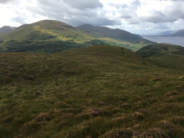
Druim na h-Earba — the ridge of the roe deer — is a 287m Marilyn in NN-square Lochaber, occupying the wooded peninsula between Loch Lochy and the lower end of Loch Arkaig at the Eas Chia-aig falls. The low summit looks east up the Great Glen and west into the timbered defile of the Dark Mile.
Quick facts
- Height
- 287.9m/ 945ft
- Prominence
- 155 m
- Grid ref
- NN 09040 71306
- Nearest city
- Fort William· 3km
- Dogs
- Dogs on lead required near livestockDog-friendly guide ↗
Height and prominence cross-checked against the Database of British and Irish Hills (CC BY).
No GPX track yet
Walked this route? Share your track to help other walkers.
Standard route
heather moorland 65% · grass slopes 25% · rocky summit 10%
Start from the Forestry and Land Scotland car park at the Eas Chia-aig falls on the B8005, taking the waymarked path past the lower fall and then leaving it to climb pathless onto the broad ridge. A short heather pull leads to a low cairn surrounded by Scots pine self-seeded over the years.
Terrain
Old Caledonian pine, birch and bracken on the lower flanks, then short heather and bilberry on the ridge crest. The ground is well drained — atypical for Lochaber — thanks to the granite that floors the area.
In winter
A coastal Marilyn under 300m: snow rarely settles for long but rime ice glazes the pine boughs and the path is then a slip hazard. Carry spikes more for ice than for snow, and headtorch as the canopy darkens early.
This hill is in the Glen Coe SAIS forecast area. Check SAIS forecasts in winter (December–April).
Best time of year
Getting there
- Glasgow3h 19m
- Edinburgh5h 28m
OS maps: OS Landranger 41, OS Explorer 391, OS Explorer 392
Mobile signal: Poor. Remote Loch Laggan area; limited coverage.
Current conditions
Daylight Today
- Sunrise
- 05:16
- Sunset
- 21:38
- Civil dawn
- 04:25
- Civil dusk
- 22:29
NOAA Solar Calculator · 30 July 2026
Around Druim na h-Earba on the SCOT network
Getting there, basing yourself, and what to do off the hill.
Base yourself in Fort William
Ben Nevis base, West Highland Line, gateway to Lochaber
3km from the hill
tripscot.co.uk
On TasteSCOTAfter the hill: Ben Nevis Distillery
Fort William — Lochaber distillery at the foot of the Ben; long-aged Japanese-owned classics
6km from the hill
tastescot.co.uk
Druim na h-Earba — common questions
- How difficult is Druim na h-Earba?
- Druim na h-Earba carries a 1/5 (easy) grade on the OutdoorSCOT scale. Ground conditions: Old Caledonian pine, birch and bracken on the lower flanks, then short heather and bilberry on the ridge crest.
- How much drop does Druim na h-Earba have?
- The drop is 155m: measured from the summit of Druim na h-Earba down to the saddle joining it to higher terrain. Passing the 150m-drop threshold on all sides is exactly what makes it a Marilyn.
- What's the best month to climb Druim na h-Earba?
- Aim for March, April, May, June, July, August, September, October on Druim na h-Earba. In the remaining months treat it as a winter hill — full kit, solid navigation, and a look at the relevant SAIS avalanche forecast before you go.
- Can dogs go up Druim na h-Earba?
- Dogs are fine on a lead. The route passes livestock or ground-nesting bird habitat, so keep them close throughout.
- Will I get phone signal on Druim na h-Earba?
- Poor. Remote Loch Laggan area; limited coverage.
- Is Druim na h-Earba safe in winter?
- A coastal Marilyn under 300m: snow rarely settles for long but rime ice glazes the pine boughs and the path is then a slip hazard. Carry spikes more for ice than for snow, and headtorch as the canopy darkens early.
Get the OutdoorSCOT weekly
One email a week — new route, hill and bothy guides, seasonal conditions and the odd hard-won lesson. No spam, unsubscribe in one click.