Marilyn · North-West Highlands
Creag a' Ghobhair
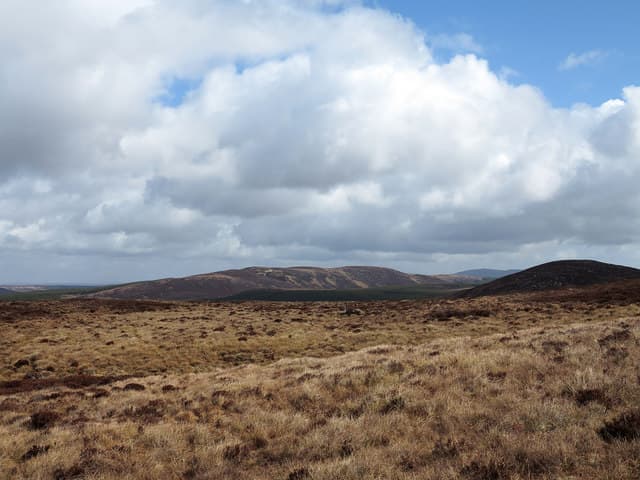
Creag a' Ghobhair — "the goat's crag" — is a 345m hill in the NH65 grid square close to Bonar Bridge. The name suggests historic goat herding on its rocky flank.
Gaelic: “crag, of the, goat” · Pronunciation: krayg uh ghobhair
Quick facts
- Height
- 345.4m/ 1133ft
- Prominence
- 175 m
- Grid ref
- NH 65974 94057
- Nearest city
- Inverness· 49km
- Dogs
- Dogs on lead required near livestockDog-friendly guide ↗
Height and prominence cross-checked against the Database of British and Irish Hills (CC BY).
No GPX track yet
Walked this route? Share your track to help other walkers.
Standard route
heather moorland 50% · rocky slopes 35% · grass slopes 15%
Park on a side road north of Bonar Bridge, follow forestry tracks then ascend the open eastern slope through gentle heather to the cairn. About 3 hours.
Terrain
Small sandstone outcrops break up well-drained heather. Forest tracks reach to within 500m of the summit area.
In winter
A low coastal hill ideal for short winter days. Forest tracks may be glazed in February when sub-zero nights follow rain.
Best time of year
Getting there
- Glasgow5h 19m
- Edinburgh6h 48m
OS maps: OS Landranger 21, OS Explorer 441W
Mobile signal: Poor. Completely off-network; Flow Country topography blocks all signals.
Current conditions
Daylight Today
- Sunrise
- 06:44
- Sunset
- 19:41
- Civil dawn
- 06:04
- Civil dusk
- 20:21
NOAA Solar Calculator · 14 September 2026
Around Creag a' Ghobhair on the SCOT network
Getting there, basing yourself, and what to do off the hill.
Creag a' Ghobhair — common questions
- Is Creag a' Ghobhair a hard climb?
- Creag a' Ghobhair is rated 1/5 (easy) on the OutdoorSCOT scale. Terrain: Small sandstone outcrops break up well-drained heather.
- How prominent is Creag a' Ghobhair?
- Creag a' Ghobhair has 175m of topographic prominence — the height of its summit above the highest col connecting it to higher ground. Marilyns are defined by that measure: at least 150m of drop on all sides.
- When should I climb Creag a' Ghobhair?
- The standard good-weather months for Creag a' Ghobhair are March, April, May, June, July, August, September, October. Outside those months, expect winter conditions on the high ground — full mountain kit, navigation skills, and a check of the SAIS avalanche forecast for the relevant region.
- Can I bring my dog up Creag a' Ghobhair?
- On a lead only — the route crosses ground with livestock or nesting-bird interest.
- What's mobile reception like on Creag a' Ghobhair?
- Poor. Completely off-network; Flow Country topography blocks all signals.
- Is Creag a' Ghobhair safe in winter?
- A low coastal hill ideal for short winter days. Forest tracks may be glazed in February when sub-zero nights follow rain.
Get the OutdoorSCOT weekly
One email a week — new route, hill and bothy guides, seasonal conditions and the odd hard-won lesson. No spam, unsubscribe in one click.