Sub-Marilyn · North-West Highlands
An Stoc-bheinn
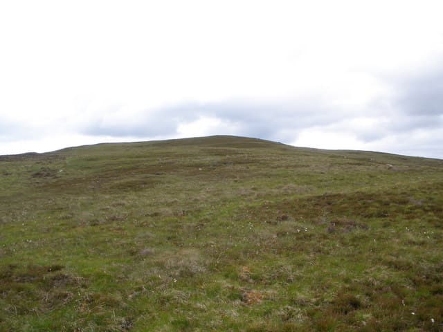
An Stoc-bheinn — "the stump hill" — stands at 336m in the NC64 grid square inland from Loth on the Sutherland coast. It rises gently from the watershed dividing the Brora and Helmsdale catchments.
Quick facts
- Height
- 336.3m/ 1103ft
- Prominence
- 147 m
- Grid ref
- NC 64159 02499
- Nearest city
- Inverness· 57km
- Dogs
- Dogs on lead required near livestockDog-friendly guide ↗
Sub-Marilyn: 147m of drop — misses the 150m Marilyn cut by 3m. We keep it on the list as a near-miss.
Height and prominence cross-checked against the Database of British and Irish Hills (CC BY).
No GPX track yet
Walked this route? Share your track to help other walkers.
Standard route
heather and bog 65% · grass slopes 25% · rocky summit 10%
Approach from the small road climbing inland from Loth on the A9, follow tracks past Loch Lunndaidh and pull onto the broad south flank. Around 4 hours.
Terrain
Damp heather and tussock with scattered erratics. The summit area carries a small cairn on a slightly raised plateau.
In winter
Sea-near location keeps snow shallow but the moorland traverse can be icy after rain-freeze. Plan a daylight return.
Best time of year
Getting there
- Glasgow6h 31m
- Edinburgh6h 1m
OS maps: OS Landranger 16, OS Explorer 441W
Mobile signal: Poor. No coverage. Inform someone before heading into this remote Sutherland glen.
Current conditions
Daylight Today
- Sunrise
- 06:44
- Sunset
- 19:42
- Civil dawn
- 06:04
- Civil dusk
- 20:22
NOAA Solar Calculator · 14 September 2026
Around An Stoc-bheinn on the SCOT network
Getting there, basing yourself, and what to do off the hill.
An Stoc-bheinn — common questions
- What difficulty is An Stoc-bheinn?
- On the OutdoorSCOT scale, An Stoc-bheinn comes in at 1/5 — easy. Ground conditions: Damp heather and tussock with scattered erratics.
- How much drop does An Stoc-bheinn have?
- The drop is 147m: measured from the summit of An Stoc-bheinn down to the saddle joining it to higher terrain. That leaves it 3m short of the 150m drop a Marilyn needs — DoBIH classes it a sub-Marilyn, a near-miss rather than a full Marilyn.
- What's the best month to climb An Stoc-bheinn?
- Aim for March, April, May, June, July, August, September, October on An Stoc-bheinn. In the remaining months treat it as a winter hill — full kit, solid navigation, and a look at the relevant SAIS avalanche forecast before you go.
- Can dogs go up An Stoc-bheinn?
- Dogs are fine on a lead. The route passes livestock or ground-nesting bird habitat, so keep them close throughout.
- Will I get phone signal on An Stoc-bheinn?
- Poor. No coverage. Inform someone before heading into this remote Sutherland glen.
- Is An Stoc-bheinn safe in winter?
- Sea-near location keeps snow shallow but the moorland traverse can be icy after rain-freeze. Plan a daylight return.
Get the OutdoorSCOT weekly
One email a week — new route, hill and bothy guides, seasonal conditions and the odd hard-won lesson. No spam, unsubscribe in one click.