Marilyn · North-West Highlands
Meall Dola
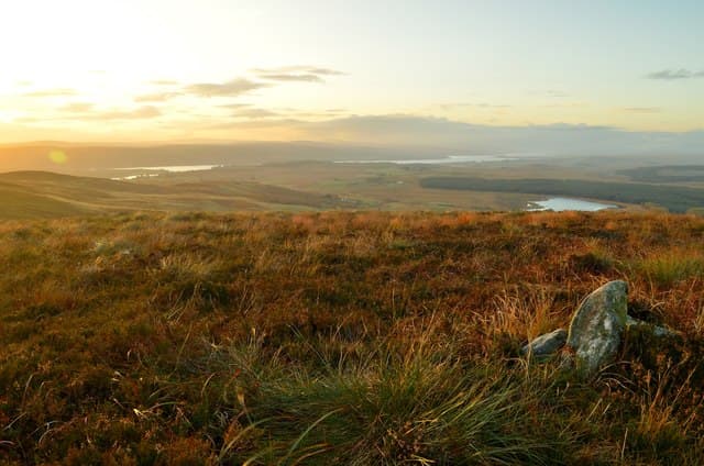
Meall Dola sits at the southern edge of the deer-haunted moorland between Strath Fleet and the Cassley, rising in long heather slopes above the forestry at the head of Strath Brora. The NC prefix places this firmly in interior Sutherland, where 323m feels considerably higher than it sounds.
Quick facts
- Height
- 323m/ 1060ft
- Prominence
- 158 m
- Grid ref
- NC 62000 06936
- Nearest city
- Inverness· 62km
- Dogs
- Dogs on lead required near livestockDog-friendly guide ↗
Height and prominence cross-checked against the Database of British and Irish Hills (CC BY).
No GPX track yet
Walked this route? Share your track to help other walkers.
Standard route
heather and bog 65% · grass slopes 25% · rocky summit 10%
Approach from the minor road through Strath Brora (NC 64), crossing rough heather and forestry edge to gain the broad south-east ridge. The summit cairn is set on a slight rocky platform with views over Loch Brora to the Easter Ross hills. Around 6 km return with 280m of climb.
Terrain
Tussocky heather and peat hags dominate the lower slopes, with the going firming up onto short grass and scattered gneiss outcrops on the summit dome. A few drainage ditches near the forestry edge need careful crossing after rain.
In winter
Snowline rarely sits below 250m here, so the hill is often walkable in early winter. Hard frost firms up the bog but ice glazes the rock platform near the top; in white-out the featureless plateau demands compass bearings.
This hill is in the Torridon SAIS forecast area. Check SAIS forecasts in winter (December–April).
Best time of year
Getting there
- Glasgow6h 37m
- Edinburgh6h 9m
OS maps: OS Landranger 16, OS Explorer 441W
Mobile signal: Poor. Signal fails on the approach glen; none on summit.
Current conditions
Daylight Today
- Sunrise
- 05:06
- Sunset
- 21:42
- Civil dawn
- 04:11
- Civil dusk
- 22:37
NOAA Solar Calculator · 30 July 2026
Around Meall Dola on the SCOT network
Getting there, basing yourself, and what to do off the hill.
Meall Dola — common questions
- How difficult is Meall Dola?
- Meall Dola carries a 1/5 (easy) grade on the OutdoorSCOT scale. Underfoot: Tussocky heather and peat hags dominate the lower slopes, with the going firming up onto short grass and scattered gneiss outcrops on the summit dome.
- What is Meall Dola's prominence?
- 158m of prominence. That's the vertical drop from the summit to the col that links Meall Dola to the next higher ground. That drop is what qualifies it as a Marilyn — a hill with at least 150m of descent on every side.
- When is the best time to climb Meall Dola?
- March, April, May, June, July, August, September, October give the most reliable conditions on Meall Dola. Beyond that window the high ground turns wintry: carry full mountain kit, be confident navigating, and check the SAIS avalanche forecast for the area.
- Is Meall Dola dog-friendly?
- Yes, but dogs must be kept on a lead — there is livestock or ground-nesting bird interest on the route.
- Is there mobile signal on Meall Dola?
- Poor. Signal fails on the approach glen; none on summit.
- Is Meall Dola safe in winter?
- Snowline rarely sits below 250m here, so the hill is often walkable in early winter. Hard frost firms up the bog but ice glazes the rock platform near the top; in white-out the featureless plateau demands compass bearings.
Get the OutdoorSCOT weekly
One email a week — new route, hill and bothy guides, seasonal conditions and the odd hard-won lesson. No spam, unsubscribe in one click.