Marilyn · North-West Highlands
Carn Garbh
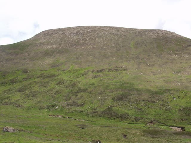
Carn Garbh — "rough cairn" — sits at 545m in the NC89 grid square between Strath Brora and Strath Fleet. A genuinely rough hill that earns its name from a chaos of broken sandstone on the upper slopes.
Gaelic: “cairn-topped hill, rough” · Pronunciation: karn garrav
Quick facts
- Height
- 545m/ 1788ft
- Prominence
- 167 m
- Grid ref
- NC 89277 13777
- Nearest city
- Inverness· 72km
- Dogs
- Dogs on lead required near livestockDog-friendly guide ↗
Height and prominence cross-checked against the Database of British and Irish Hills (CC BY).
No GPX track yet
Walked this route? Share your track to help other walkers.
Standard route
heather and bog 55% · rocky slopes 30% · grass slopes 15%
Drive up Strath Brora to Balnacoil, then follow estate tracks south before climbing the northwest spur. Allow 5 hours for the round trip.
Terrain
Block-strewn sandstone tops the hill, awkward to walk on and worse in rain. Lower slopes are gentle heather with the odd bog patch.
In winter
Iced blocks on the summit make the top genuinely awkward in winter. The sandstone holds rime well; respect the wind chill on this exposed top.
Best time of year
Getting there
- Glasgow6h 52m
- Edinburgh6h 50m
OS maps: OS Landranger 17, OS Explorer 444W
Mobile signal: Poor. Dead zone—no networks reach this remote Sutherland plateau.
Current conditions
Daylight Today
- Sunrise
- 06:42
- Sunset
- 19:40
- Civil dawn
- 06:02
- Civil dusk
- 20:20
NOAA Solar Calculator · 14 September 2026
Around Carn Garbh on the SCOT network
Getting there, basing yourself, and what to do off the hill.
Carn Garbh — common questions
- Is Carn Garbh a hard climb?
- Carn Garbh is rated 2/5 (moderate) on the OutdoorSCOT scale. Terrain: Block-strewn sandstone tops the hill, awkward to walk on and worse in rain.
- How prominent is Carn Garbh?
- Carn Garbh has 167m of topographic prominence — the height of its summit above the highest col connecting it to higher ground. Marilyns are defined by that measure: at least 150m of drop on all sides.
- When should I climb Carn Garbh?
- The standard good-weather months for Carn Garbh are March, April, May, June, July, August, September, October. Outside those months, expect winter conditions on the high ground — full mountain kit, navigation skills, and a check of the SAIS avalanche forecast for the relevant region.
- Can I bring my dog up Carn Garbh?
- On a lead only — the route crosses ground with livestock or nesting-bird interest.
- What's mobile reception like on Carn Garbh?
- Poor. Dead zone—no networks reach this remote Sutherland plateau.
- Is Carn Garbh safe in winter?
- Iced blocks on the summit make the top genuinely awkward in winter. The sandstone holds rime well; respect the wind chill on this exposed top.
Get the OutdoorSCOT weekly
One email a week — new route, hill and bothy guides, seasonal conditions and the odd hard-won lesson. No spam, unsubscribe in one click.