Marilyn · North-West Highlands
Beinn Dubhain
Beinn Dubhain — possibly "wee dark hill" — is a 417m heathery dome in the NC93 grid square south of Kinbrace, deep in the Langwell-Helmsdale watershed. North-West Highlands summit at 417 m.
Quick facts
- Height
- 417m/ 1368ft
- Prominence
- 223 m
- Grid ref
- NC 93682 20704
- Nearest city
- Inverness· 80km
- Dogs
- Dogs on lead required near livestockDog-friendly guide ↗
Height and prominence cross-checked against the Database of British and Irish Hills (CC BY).
No GPX track yet
Walked this route? Share your track to help other walkers.
Standard route
heather and bog 65% · grass slopes 25% · rocky summit 10%
Park at the head of the Helmsdale strath near Kildonan, then follow estate tracks west and pull onto the southern flank of the hill. Allow 4-5 hours.
Terrain
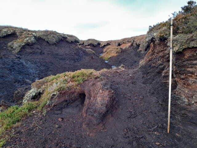
Coarse heather and dark peat give the hill its name. Lower slopes are crossed by old grouse butts and tracks; the cairn sits on a small mossy rise.
In winter
Short days are the chief winter concern. Snow rarely lies deep but ground ice on the track makes the bike-in approach risky.
This hill is in the Torridon SAIS forecast area. Check SAIS forecasts in winter (December–April).
Best time of year
Getting there
- Glasgow6h 4m
- Edinburgh6h 57m
OS maps: OS Landranger 17, OS Explorer 444W
Mobile signal: Poor. No signal. Remote North-West Sutherland is largely off-grid.
Current conditions
Daylight Today
- Sunrise
- 05:03
- Sunset
- 21:41
- Civil dawn
- 04:08
- Civil dusk
- 22:36
NOAA Solar Calculator · 30 July 2026
Around Beinn Dubhain on the SCOT network
Getting there, basing yourself, and what to do off the hill.
Beinn Dubhain — common questions
- How difficult is Beinn Dubhain?
- Beinn Dubhain carries a 1/5 (easy) grade on the OutdoorSCOT scale. Underfoot: Coarse heather and dark peat give the hill its name.
- What is Beinn Dubhain's prominence?
- 223m of prominence. That's the vertical drop from the summit to the col that links Beinn Dubhain to the next higher ground. That drop is what qualifies it as a Marilyn — a hill with at least 150m of descent on every side.
- When is the best time to climb Beinn Dubhain?
- March, April, May, June, July, August, September, October give the most reliable conditions on Beinn Dubhain. Beyond that window the high ground turns wintry: carry full mountain kit, be confident navigating, and check the SAIS avalanche forecast for the area.
- Is Beinn Dubhain dog-friendly?
- Yes, but dogs must be kept on a lead — there is livestock or ground-nesting bird interest on the route.
- Is there mobile signal on Beinn Dubhain?
- Poor. No signal. Remote North-West Sutherland is largely off-grid.
- Is Beinn Dubhain safe in winter?
- Short days are the chief winter concern. Snow rarely lies deep but ground ice on the track makes the bike-in approach risky.
Get the OutdoorSCOT weekly
One email a week — new route, hill and bothy guides, seasonal conditions and the odd hard-won lesson. No spam, unsubscribe in one click.