Marilyn · Skye
Ben Geary
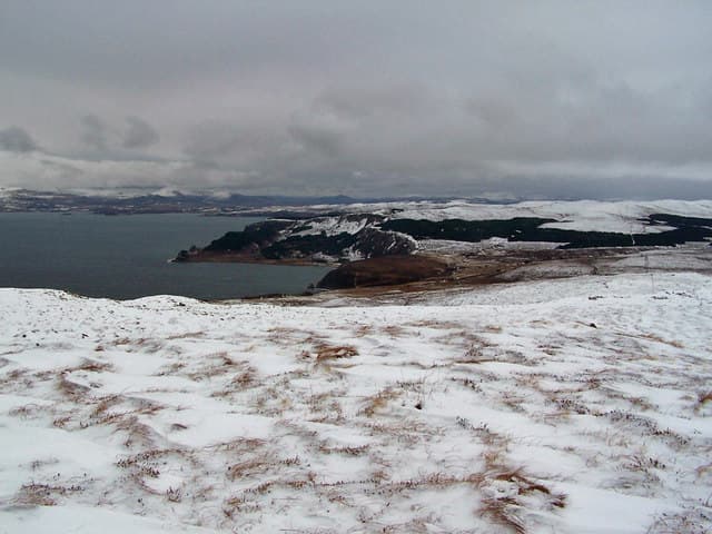
Ben Geary stands at the very tip of the Waternish peninsula, the NG 25 61 grid putting it within sight of Waternish Point lighthouse and the Outer Hebrides across the Minch. The hill takes its name from the nearby crofting hamlet of Geary on Skye's north coast.
Quick facts
- Height
- 284m/ 932ft
- Prominence
- 166 m
- Grid ref
- NG 25363 61463
- Dogs
- Dogs on lead required near livestockDog-friendly guide ↗
Height and prominence cross-checked against the Database of British and Irish Hills (CC BY).
No GPX track yet
Walked this route? Share your track to help other walkers.
Standard route
heather moorland 55% · grass slopes 30% · rocky summit 15%
Park at Trumpan church (NG 22 61) and follow the old road north-east toward Geary, then climb the open hillside to the summit. The cairn sits on a small basalt cap above grazing land. Around 6 km return with 230m of climb.
Terrain
Coastal sheep pasture giving way to shorter heath on the upper hillside. The summit cap is a small rocky platform with views directly out to Harris and Lewis on a clear day.
In winter
A genuine sea-level base — snow rarely lies and the hill is usually walkable year-round. The greatest risk is salt-spray ice on the summit rocks during onshore gales.
Best time of year
Getting there
- Glasgow7h 29m
- Edinburgh10h 45m
OS maps: OS Landranger 23, OS Explorer 407
Mobile signal: Close to none. No signal to speak of; carry a PLB on this remote Skye hill.
Current conditions
Daylight Today
- Sunrise
- 05:18
- Sunset
- 21:48
- Civil dawn
- 04:24
- Civil dusk
- 22:42
NOAA Solar Calculator · 30 July 2026
Around Ben Geary on the SCOT network
Getting there, basing yourself, and what to do off the hill.
Ben Geary — common questions
- How difficult is Ben Geary?
- Ben Geary carries a 1/5 (easy) grade on the OutdoorSCOT scale. Underfoot: Coastal sheep pasture giving way to shorter heath on the upper hillside.
- What is Ben Geary's prominence?
- 166m of prominence. That's the vertical drop from the summit to the col that links Ben Geary to the next higher ground. That drop is what qualifies it as a Marilyn — a hill with at least 150m of descent on every side.
- When is the best time to climb Ben Geary?
- March, April, May, June, July, August, September, October give the most reliable conditions on Ben Geary. Beyond that window the high ground turns wintry: carry full mountain kit, be confident navigating, and check the SAIS avalanche forecast for the area.
- Is Ben Geary dog-friendly?
- Yes, but dogs must be kept on a lead — there is livestock or ground-nesting bird interest on the route.
- Is there mobile signal on Ben Geary?
- Close to none. No signal to speak of; carry a PLB on this remote Skye hill.
- Is Ben Geary safe in winter?
- A genuine sea-level base — snow rarely lies and the hill is usually walkable year-round. The greatest risk is salt-spray ice on the summit rocks during onshore gales.
Get the OutdoorSCOT weekly
One email a week — new route, hill and bothy guides, seasonal conditions and the odd hard-won lesson. No spam, unsubscribe in one click.