Marilyn · North-West Highlands
Beinn Sgeireach
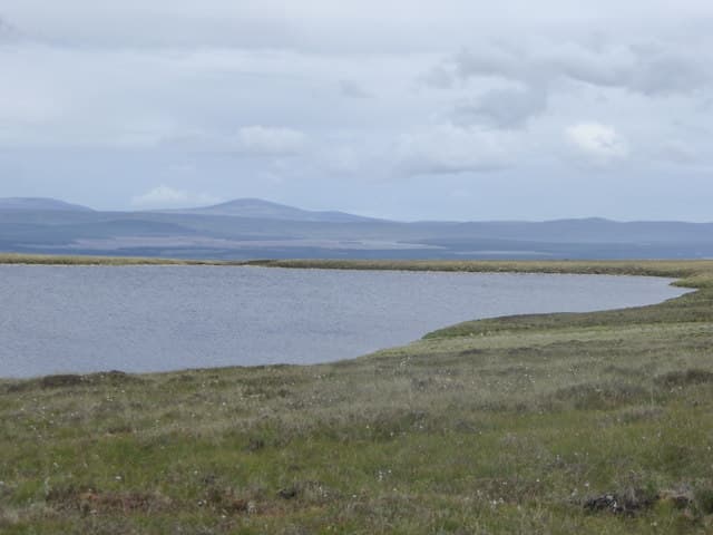
Beinn Sgeireach — the Skerry-Hill — sits at the head of Loch Shin's western arm in the great empty quarter between Crask and Overscaig. The NC 45 11 grid puts it among the lochan-pitted moors that drain south to the Shin, with Ben Klibreck filling the eastern horizon.
Quick facts
- Height
- 476m/ 1562ft
- Prominence
- 157 m
- Grid ref
- NC 45357 11812
- Nearest city
- Inverness· 70km
- Dogs
- Dogs on lead required near livestockDog-friendly guide ↗
Height and prominence cross-checked against the Database of British and Irish Hills (CC BY).
No GPX track yet
Walked this route? Share your track to help other walkers.
Standard route
heather moorland 50% · rocky slopes 35% · grass slopes 15%
Best approached from the A838 near Loch Merkland (NC 39 28), following the estate track south-east before striking up the broad north ridge. The summit cairn is set on a small rocky platform looking south over Lochan a' Bhealaich. Around 13 km return with 420m of ascent.
Terrain
A patchwork of low gneiss skerries — small rocky outcrops separated by saturated peat. The upper slopes firm up to short heath but the lower approach is among the wettest going in Sutherland.
In winter
Freezing the bogs makes this hill far more pleasant in winter than summer, and snow seldom lies deep on the modest summit. Watch for verglas glazing the skerries after thaw-refreeze cycles.
This hill is in the Torridon SAIS forecast area. Check SAIS forecasts in winter (December–April).
Best time of year
Getting there
- Glasgow6h 48m
- Edinburgh7h 37m
OS maps: OS Landranger 16, OS Explorer 440S
Mobile signal: Poor. An all-network dead zone; OS map and compass essential.
Current conditions
Daylight Today
- Sunrise
- 05:07
- Sunset
- 21:43
- Civil dawn
- 04:12
- Civil dusk
- 22:38
NOAA Solar Calculator · 30 July 2026
Around Beinn Sgeireach on the SCOT network
Getting there, basing yourself, and what to do off the hill.
Beinn Sgeireach — common questions
- How difficult is Beinn Sgeireach?
- Beinn Sgeireach carries a 1/5 (easy) grade on the OutdoorSCOT scale. Terrain: A patchwork of low gneiss skerries — small rocky outcrops separated by saturated peat.
- How prominent is Beinn Sgeireach?
- Beinn Sgeireach has 157m of topographic prominence — the height of its summit above the highest col connecting it to higher ground. Marilyns are defined by that measure: at least 150m of drop on all sides.
- When should I climb Beinn Sgeireach?
- The standard good-weather months for Beinn Sgeireach are March, April, May, June, July, August, September, October. Outside those months, expect winter conditions on the high ground — full mountain kit, navigation skills, and a check of the SAIS avalanche forecast for the relevant region.
- Can I bring my dog up Beinn Sgeireach?
- On a lead only — the route crosses ground with livestock or nesting-bird interest.
- What's mobile reception like on Beinn Sgeireach?
- Poor. An all-network dead zone; OS map and compass essential.
- Is Beinn Sgeireach safe in winter?
- Freezing the bogs makes this hill far more pleasant in winter than summer, and snow seldom lies deep on the modest summit. Watch for verglas glazing the skerries after thaw-refreeze cycles.
Get the OutdoorSCOT weekly
One email a week — new route, hill and bothy guides, seasonal conditions and the odd hard-won lesson. No spam, unsubscribe in one click.