Marilyn · North-West Highlands
Maovally
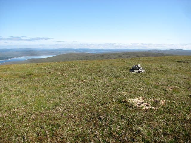
Maovally is the pale quartzite cap rising above the Rhiconich-to-Kinlochbervie road on the edge of the Reay Forest. The NC 37 21 square lies within sight of Foinaven and Arkle, and the hill is a fine viewpoint for the entire Cape Wrath peninsula.
Quick facts
- Height
- 511m/ 1677ft
- Prominence
- 199 m
- Grid ref
- NC 37820 21196
- Nearest city
- Inverness· 81km
- Dogs
- Dogs on lead required near livestockDog-friendly guide ↗
Height and prominence cross-checked against the Database of British and Irish Hills (CC BY).
No GPX track yet
Walked this route? Share your track to help other walkers.
Standard route
blanket bog 55% · heather moorland 30% · rocky summit 15%
Park at the Achriesgill road end (NC 25 54) or set out from the A838 layby near Loch Garbet Beag. A trackless ascent of the west flank crosses cnocan country and steepens onto the quartzite summit ridge. About 9 km return with 500m of climb.
Terrain
Classic knock-and-lochan terrain — small rock domes separated by waterlogged hollows, with no continuous path. The summit ridge is bare quartzite scree, loose underfoot but mercifully drier than the approach.
In winter
In a north-westerly the hill catches the brunt of Atlantic squalls and rime ice forms on the scree. Snow does not lie long but verglas on quartzite slabs is a real hazard; pick a settled cold spell.
This hill is in the Torridon SAIS forecast area. Check SAIS forecasts in winter (December–April).
Best time of year
Getting there
- Glasgow6h 4m
- Edinburgh7h 59m
OS maps: OS Landranger 16, OS Explorer 440N
Mobile signal: Poor. Remote north Sutherland coast area; all networks fail on this hill.
Current conditions
Daylight Today
- Sunrise
- 05:07
- Sunset
- 21:44
- Civil dawn
- 04:11
- Civil dusk
- 22:40
NOAA Solar Calculator · 30 July 2026
Around Maovally on the SCOT network
Getting there, basing yourself, and what to do off the hill.
Maovally — common questions
- How hard is Maovally?
- We grade Maovally at 2/5, which puts it in moderate territory. Ground conditions: Classic knock-and-lochan terrain — small rock domes separated by waterlogged hollows, with no continuous path.
- How much drop does Maovally have?
- The drop is 199m: measured from the summit of Maovally down to the saddle joining it to higher terrain. Passing the 150m-drop threshold on all sides is exactly what makes it a Marilyn.
- What's the best month to climb Maovally?
- Aim for March, April, May, June, July, August, September, October on Maovally. In the remaining months treat it as a winter hill — full kit, solid navigation, and a look at the relevant SAIS avalanche forecast before you go.
- Can dogs go up Maovally?
- Dogs are fine on a lead. The route passes livestock or ground-nesting bird habitat, so keep them close throughout.
- Will I get phone signal on Maovally?
- Poor. Remote north Sutherland coast area; all networks fail on this hill.
- Is Maovally safe in winter?
- In a north-westerly the hill catches the brunt of Atlantic squalls and rime ice forms on the scree. Snow does not lie long but verglas on quartzite slabs is a real hazard; pick a settled cold spell.
Get the OutdoorSCOT weekly
One email a week — new route, hill and bothy guides, seasonal conditions and the odd hard-won lesson. No spam, unsubscribe in one click.