Marilyn · North-West Highlands
Creag Dhubh Bheag
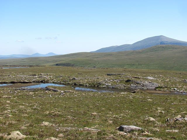
The "little black crag" sits at 472m in the NC47 grid square, a quiet neighbour of Creag Dhubh Mhor on the western side of the Cassley watershed. Twin Marilyns rarely come paired this neatly.
Gaelic: “crag, black, small” · Pronunciation: krayg goo vek
Quick facts
- Height
- 472m/ 1549ft
- Prominence
- 203 m
- Grid ref
- NC 47485 30753
- Nearest city
- Inverness· 87km
- Dogs
- Dogs on lead required near livestockDog-friendly guide ↗
Height and prominence cross-checked against the Database of British and Irish Hills (CC BY).
No GPX track yet
Walked this route? Share your track to help other walkers.
Standard route
heather moorland 55% · rocky slopes 30% · grass slopes 15%
Combine with Creag Dhubh Mhor as a long pathless round from the A837 at Rosehall, or tackle solo via the same valley with a final pull up the northern flank. Around 5 hours.
Terrain
Knobbly gneiss outcrops with deep heather between. The crag face on the north-east side should be skirted, not descended directly.
In winter
Frequent freeze-thaw glazes the dark slabs and makes the steeper northern aspect surprisingly hazardous. Stay on the southern slope when ice is suspected.
This hill is in the Torridon SAIS forecast area. Check SAIS forecasts in winter (December–April).
Best time of year
Getting there
- Glasgow6h 13m
- Edinburgh7h 57m
OS maps: OS Landranger 16, OS Explorer 440N
Mobile signal: Poor. EE and O2 both fail; only brief Vodafone blips on the highest point occasionally.
Current conditions
Daylight Today
- Sunrise
- 05:06
- Sunset
- 21:44
- Civil dawn
- 04:10
- Civil dusk
- 22:40
NOAA Solar Calculator · 30 July 2026
Around Creag Dhubh Bheag on the SCOT network
Getting there, basing yourself, and what to do off the hill.
Creag Dhubh Bheag — common questions
- What difficulty is Creag Dhubh Bheag?
- On the OutdoorSCOT scale, Creag Dhubh Bheag comes in at 1/5 — easy. Ground conditions: Knobbly gneiss outcrops with deep heather between.
- How much drop does Creag Dhubh Bheag have?
- The drop is 203m: measured from the summit of Creag Dhubh Bheag down to the saddle joining it to higher terrain. Passing the 150m-drop threshold on all sides is exactly what makes it a Marilyn.
- What's the best month to climb Creag Dhubh Bheag?
- Aim for March, April, May, June, July, August, September, October on Creag Dhubh Bheag. In the remaining months treat it as a winter hill — full kit, solid navigation, and a look at the relevant SAIS avalanche forecast before you go.
- Can dogs go up Creag Dhubh Bheag?
- Dogs are fine on a lead. The route passes livestock or ground-nesting bird habitat, so keep them close throughout.
- Will I get phone signal on Creag Dhubh Bheag?
- Poor. EE and O2 both fail; only brief Vodafone blips on the highest point occasionally.
- Is Creag Dhubh Bheag safe in winter?
- Frequent freeze-thaw glazes the dark slabs and makes the steeper northern aspect surprisingly hazardous. Stay on the southern slope when ice is suspected.
Get the OutdoorSCOT weekly
One email a week — new route, hill and bothy guides, seasonal conditions and the odd hard-won lesson. No spam, unsubscribe in one click.