Marilyn · North-West Highlands
Meall an Fhuarain
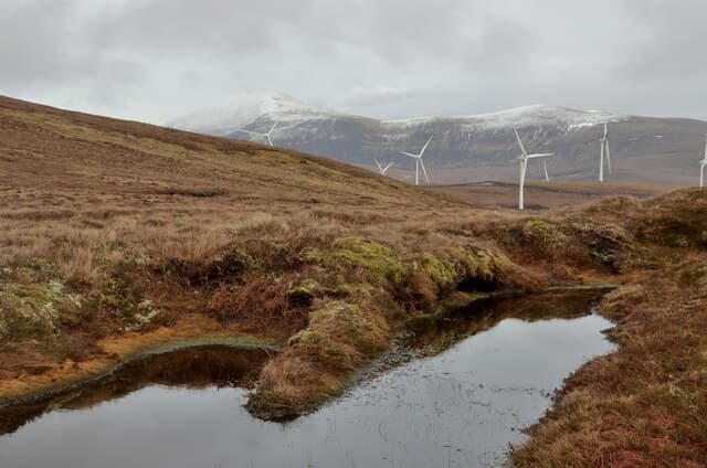
Meall an Fhuarain — "hill of the cold spring" — is a grassy 472m dome in the NC51 square, lying between Loch Shin and the upper Cassley valley. A solitary lochan marks its eastern flank.
Quick facts
- Height
- 472m/ 1549ft
- Prominence
- 215 m
- Grid ref
- NC 51324 30533
- Nearest city
- Inverness· 86km
- Dogs
- Dogs on lead required near livestockDog-friendly guide ↗
Height and prominence cross-checked against the Database of British and Irish Hills (CC BY).
No GPX track yet
Walked this route? Share your track to help other walkers.
Standard route
blanket bog 55% · heather moorland 30% · grassy summit 15%
Approach via the forestry tracks above Achnairn on Loch Shin, then follow a forest ride out onto open hill and curve up the south ridge. Allow 3-4 hours round trip.
Terrain
Newly thinned conifer plantations on the lower flanks open onto cropped grassland near the cairn. Watch for stumps and brash in the deer fence zone.
In winter
A relatively short day suited to crisp winter conditions when the bog is frozen. Plantation rides hold deep snow long after the open hill clears.
Kit for this: the winter Munro kit list · which boots take crampons
Best time of year
Getting there
- Glasgow6h 12m
- Edinburgh7h 52m
OS maps: OS Landranger 16, OS Explorer 443
Mobile signal: Very poor. Central Sutherland; no reliable coverage.
Current conditions
Daylight Today
- Sunrise
- 07:13
- Sunset
- 19:06
- Civil dawn
- 06:34
- Civil dusk
- 19:45
NOAA Solar Calculator · 27 September 2026
Around Meall an Fhuarain on the SCOT network
Getting there, basing yourself, and what to do off the hill.
Meall an Fhuarain — common questions
- Is Meall an Fhuarain a hard climb?
- Meall an Fhuarain is rated 1/5 (easy) on the OutdoorSCOT scale. Terrain: Newly thinned conifer plantations on the lower flanks open onto cropped grassland near the cairn.
- How prominent is Meall an Fhuarain?
- Meall an Fhuarain has 215m of topographic prominence — the height of its summit above the highest col connecting it to higher ground. Marilyns are defined by that measure: at least 150m of drop on all sides.
- When should I climb Meall an Fhuarain?
- The standard good-weather months for Meall an Fhuarain are March, April, May, June, July, August, September, October. Outside those months, expect winter conditions on the high ground — full mountain kit, navigation skills, and a check of the SAIS avalanche forecast for the relevant region.
- Can I bring my dog up Meall an Fhuarain?
- On a lead only — the route crosses ground with livestock or nesting-bird interest.
- What's mobile reception like on Meall an Fhuarain?
- Very poor. Central Sutherland; no reliable coverage.
- Is Meall an Fhuarain safe in winter?
- A relatively short day suited to crisp winter conditions when the bog is frozen. Plantation rides hold deep snow long after the open hill clears.
Get the OutdoorSCOT weekly
One email a week — new route, hill and bothy guides, seasonal conditions and the odd hard-won lesson. No spam, unsubscribe in one click.