Marilyn · Outer Hebrides
Beinn Dhubh
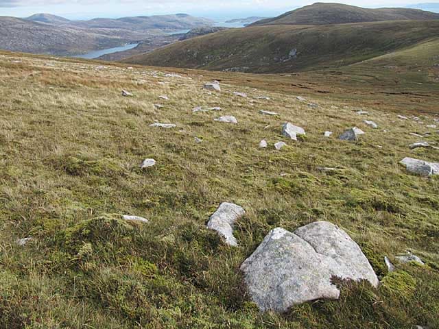
Beinn Dhubh, the dark hill, forms the long ridge above Luskentyre on south Harris and offers what many regard as the finest view in the islands. The summit looks straight down onto white shell beaches and turquoise sea on one side and inland to the dark Harris hills on the other.
Gaelic: “mountain, black” · Pronunciation: bine goo
Quick facts
- Height
- 506m/ 1660ft
- Prominence
- 493 m
- Grid ref
- NB 08964 00627
- Dogs
- Dogs on lead required near livestockDog-friendly guide ↗
Height and prominence cross-checked against the Database of British and Irish Hills (CC BY).
No GPX track yet
Walked this route? Share your track to help other walkers.
Standard route
Lewisian gneiss 45% · blanket bog 35% · rocky summit 20%
A clear walkers track climbs the eastern shoulder from the road near Borvemore, leading along a broad grassy ridge to the summit. Around four hours return with easy gradients and a real sense of height for the modest effort.
Terrain
Stalkers path and short grass for most of the route, with a few wet patches and a stonier final ridge. Dry and well drained compared to other Harris hills.
In winter
A good winter hill with little permanent snow but expect ice on the path and strong exposure on the ridge. Excellent low-snow alternative to mainland routes.
Best time of year
Getting there
- Glasgow9h 41m
- Edinburgh11h 53m
Ferry access
Uig (Skye) → Tarbert (Harris)
- Crossing time105 min
- Summer sailings2 sailings daily (Apr–Oct)
- Winter sailings1 sailing daily (Nov–Mar)
- Book ahead14 days
- Last ferry backCheck CalMac timetable — last sailing to Uig varies seasonally
Drive to Uig on Skye (Skye Bridge from Kyle of Lochalsh), then ferry to Harris. Alternative: Ullapool → Stornoway (Lewis, 2h45) and drive south.
Book on CalMac ↗OS maps: OS Landranger 14, OS Landranger 18, OS Explorer 455, OS Explorer 456
Mobile signal: Weak. signal falls away en route; Lewisian gneiss of Harris gives zero coverage.
Current conditions
Daylight Today
- Sunrise
- 05:17
- Sunset
- 21:51
- Civil dawn
- 04:22
- Civil dusk
- 22:46
NOAA Solar Calculator · 30 July 2026
Around Beinn Dhubh on the SCOT network
Getting there, basing yourself, and what to do off the hill.
Beinn Dhubh — common questions
- How difficult is Beinn Dhubh?
- Beinn Dhubh carries a 2/5 (moderate) grade on the OutdoorSCOT scale. Ground conditions: Stalkers path and short grass for most of the route, with a few wet patches and a stonier final ridge.
- How much drop does Beinn Dhubh have?
- The drop is 493m: measured from the summit of Beinn Dhubh down to the saddle joining it to higher terrain. Passing the 150m-drop threshold on all sides is exactly what makes it a Marilyn.
- What's the best month to climb Beinn Dhubh?
- Aim for March, April, May, June, July, August, September, October on Beinn Dhubh. In the remaining months treat it as a winter hill — full kit, solid navigation, and a look at the relevant SAIS avalanche forecast before you go.
- Can dogs go up Beinn Dhubh?
- Dogs are fine on a lead. The route passes livestock or ground-nesting bird habitat, so keep them close throughout.
- Will I get phone signal on Beinn Dhubh?
- Weak. signal falls away en route; Lewisian gneiss of Harris gives zero coverage.
- How do I get the ferry to Beinn Dhubh?
- Uig (Skye) → Tarbert (Harris). 2 sailings daily (Apr–Oct) in summer; 1 sailing daily (Nov–Mar) in winter. Book at least 14 days ahead. Drive to Uig on Skye (Skye Bridge from Kyle of Lochalsh), then ferry to Harris. Alternative: Ullapool → Stornoway (Lewis, 2h45) and drive south.
- Is Beinn Dhubh safe in winter?
- A good winter hill with little permanent snow but expect ice on the path and strong exposure on the ridge. Excellent low-snow alternative to mainland routes.
Get the OutdoorSCOT weekly
One email a week — new route, hill and bothy guides, seasonal conditions and the odd hard-won lesson. No spam, unsubscribe in one click.