Marilyn · Argyll
Beinn Chapull
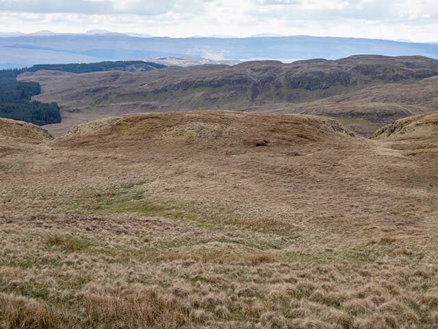
Beinn Chapull, the Hill of the Horse, is a 515m Marilyn rising above the head of Loch Avich in mid-Argyll. Its compact dome sits in remote country with few visitors.
Quick facts
- Height
- 515m/ 1690ft
- Prominence
- 268 m
- Grid ref
- NM 93741 19598
- Nearest city
- Oban· 13km
- Dogs
- Dogs on lead required near livestockDog-friendly guide ↗
Height and prominence cross-checked against the Database of British and Irish Hills (CC BY).
No GPX track yet
Walked this route? Share your track to help other walkers.
Standard route
heather and bog 65% · grass slopes 25% · rocky summit 10%
A typical ascent starts from the minor road along Loch Avich, threading through forestry rides before climbing rough heather to the summit. Map work matters; 3 to 5 hours is a fair estimate depending on tree-cover obstacles.
Terrain
Dense plantation on the lower slopes can frustrate route choice. Above, the ground is wet heather and bog with sparse outcrop. A burn line often makes the most reliable guide.
In winter
Sheltered location keeps it mild for an Argyll hill, but bog freezes hard and tussocks become hidden traps under thin snow. Microspikes can help on the upper ground.
Best time of year
Getting there
- Glasgow3h 3m
- Edinburgh6h 38m
OS maps: OS Landranger 55, OS Explorer 360N
Mobile signal: Poor. Networks fail completely; download offline maps in advance.
Current conditions
Daylight Today
- Sunrise
- 05:19
- Sunset
- 21:36
- Civil dawn
- 04:29
- Civil dusk
- 22:26
NOAA Solar Calculator · 30 July 2026
Around Beinn Chapull on the SCOT network
Getting there, basing yourself, and what to do off the hill.
Getting there: Oban station
Argyll ferry hub; Mull, Lismore, Coll, Tiree, Barra connections
13km from the hill
tripscot.co.uk
On TripSCOTBase yourself in Oban
Argyll ferry hub — Mull, Lismore, Coll, Tiree, Barra
13km from the hill
tripscot.co.uk
On TasteSCOTAfter the hill: Oban
Oban town centre — tiny two-still distillery bridging Highland and West Coast styles
13km from the hill
tastescot.co.uk
Beinn Chapull — common questions
- What difficulty is Beinn Chapull?
- On the OutdoorSCOT scale, Beinn Chapull comes in at 2/5 — moderate. Ground conditions: Dense plantation on the lower slopes can frustrate route choice.
- How much drop does Beinn Chapull have?
- The drop is 268m: measured from the summit of Beinn Chapull down to the saddle joining it to higher terrain. Passing the 150m-drop threshold on all sides is exactly what makes it a Marilyn.
- What's the best month to climb Beinn Chapull?
- Aim for March, April, May, June, July, August, September, October on Beinn Chapull. In the remaining months treat it as a winter hill — full kit, solid navigation, and a look at the relevant SAIS avalanche forecast before you go.
- Can dogs go up Beinn Chapull?
- Dogs are fine on a lead. The route passes livestock or ground-nesting bird habitat, so keep them close throughout.
- Will I get phone signal on Beinn Chapull?
- Poor. Networks fail completely; download offline maps in advance.
- Is Beinn Chapull safe in winter?
- Sheltered location keeps it mild for an Argyll hill, but bog freezes hard and tussocks become hidden traps under thin snow. Microspikes can help on the upper ground.
Get the OutdoorSCOT weekly
One email a week — new route, hill and bothy guides, seasonal conditions and the odd hard-won lesson. No spam, unsubscribe in one click.