Marilyn · Argyll & Bute
Carn Dearg
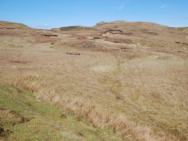
Carn Dearg, the Red Cairn, is a 437m hill in the wild country between Lochs Awe and Avich. Its summit cairn sits on warm-toned schist that gives the hill its name.
Gaelic: “cairn-topped hill, red” · Pronunciation: karn jerr-ak
Quick facts
- Height
- 437m/ 1434ft
- Prominence
- 174 m
- Grid ref
- NM 89617 18969
- Nearest city
- Oban· 12km
- Dogs
- Dogs on lead required near livestockDog-friendly guide ↗
Height and prominence cross-checked against the Database of British and Irish Hills (CC BY).
No GPX track yet
Walked this route? Share your track to help other walkers.
Standard route
heather and bog 60% · rocky slopes 25% · grass slopes 15%
A practical line follows the minor road and forestry tracks from the south end of Loch Avich, then climbs over rough ground onto the broad summit ridge. Reckon on 3 to 4 hours return for an undemanding round.
Terrain
Conifer plantation on the lower flanks gives way to open heather and grass with the occasional reddish rock band. The summit ridge is broad and undulating.
In winter
Mild winter conditions usually prevail at this height, though hard frosts make iced peat hags treacherous. Plan an early start to make best use of short Argyll daylight.
Best time of year
Getting there
- Glasgow3h 12m
- Edinburgh6h 48m
OS maps: OS Landranger 55, OS Explorer 359
Mobile signal: Poor. Neither EE nor Vodafone works on this remote Argyll summit.
Current conditions
Daylight Today
- Sunrise
- 06:50
- Sunset
- 19:44
- Civil dawn
- 06:12
- Civil dusk
- 20:22
NOAA Solar Calculator · 14 September 2026
Around Carn Dearg on the SCOT network
Getting there, basing yourself, and what to do off the hill.
Getting there: Oban station
Argyll ferry hub; Mull, Lismore, Coll, Tiree, Barra connections
11km from the hill
tripscot.co.uk
On TripSCOTBase yourself in Oban
Argyll ferry hub — Mull, Lismore, Coll, Tiree, Barra
11km from the hill
tripscot.co.uk
On TasteSCOTAfter the hill: Oban
Oban town centre — tiny two-still distillery bridging Highland and West Coast styles
12km from the hill
tastescot.co.uk
Carn Dearg — common questions
- What difficulty is Carn Dearg?
- On the OutdoorSCOT scale, Carn Dearg comes in at 1/5 — easy. Underfoot: Conifer plantation on the lower flanks gives way to open heather and grass with the occasional reddish rock band.
- What is Carn Dearg's prominence?
- 174m of prominence. That's the vertical drop from the summit to the col that links Carn Dearg to the next higher ground. That drop is what qualifies it as a Marilyn — a hill with at least 150m of descent on every side.
- When is the best time to climb Carn Dearg?
- March, April, May, June, July, August, September, October give the most reliable conditions on Carn Dearg. Beyond that window the high ground turns wintry: carry full mountain kit, be confident navigating, and check the SAIS avalanche forecast for the area.
- Is Carn Dearg dog-friendly?
- Yes, but dogs must be kept on a lead — there is livestock or ground-nesting bird interest on the route.
- Is there mobile signal on Carn Dearg?
- Poor. Neither EE nor Vodafone works on this remote Argyll summit.
- Is Carn Dearg safe in winter?
- Mild winter conditions usually prevail at this height, though hard frosts make iced peat hags treacherous. Plan an early start to make best use of short Argyll daylight.
Get the OutdoorSCOT weekly
One email a week — new route, hill and bothy guides, seasonal conditions and the odd hard-won lesson. No spam, unsubscribe in one click.