Marilyn · Skye & The Small Isles
Beinn Bhreac
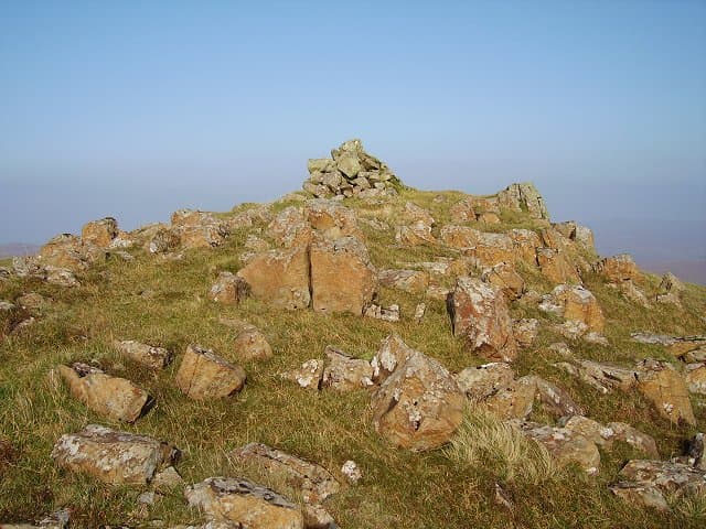
Beinn Bhreac (speckled hill) is a 448m moorland top above Bracadale in central Skye, with a fine elevated view across Loch Bracadale to MacLeod's Tables and the Cuillin. The summit area is a mosaic of basalt outcrops and lochans.
Quick facts
- Height
- 448m/ 1470ft
- Grid ref
- NG 34576 26942
- Dogs
- Dogs on lead required near livestockDog-friendly guide ↗
No GPX track yet
Walked this route? Share your track to help other walkers.
Standard route
rough grassland 45% · basalt rock 35% · heather 20%
Park near Struan or Bracadale and head south-east across open moor to gain the broad ridge. Expect 7 km return and roughly 350m of ascent on pathless ground.
Terrain
Deep peat hags interspersed with basalt platforms and small lochans. Choose lines carefully to avoid the worst of the bog after rain.
In winter
Frozen bog makes the walking easier than in summer. Snow showers driven on Atlantic winds can reduce visibility quickly on the featureless plateau.
Best time of year
Getting there
- Glasgow7h 38m
- Edinburgh9h 58m
OS maps: OS Landranger 32, OS Explorer 411
Mobile signal: Moderate. EE intermittent on Skye; better toward Portree.
Current conditions
Daylight Today
- Sunrise
- 04:31
- Sunset
- 22:26
- Civil dawn
- 03:22
- Civil dusk
- 23:36
NOAA Solar Calculator · 27 June 2026
Around Beinn Bhreac on the SCOT network
Getting there, basing yourself, and what to do off the hill.
Getting there: Kyle of Lochalsh station
Skye Bridge; Five Sisters of Kintail; Glen Shiel; Plockton
41km from the hill
tripscot.co.uk
On TripSCOTBase yourself in Portree
Main Skye base — Cuillin, Trotternish, Storr
21km from the hill
tripscot.co.uk
On TasteSCOTAfter the hill: Talisker
Carbost on Skye — Cuillin foothills distillery; peppery, maritime, big-bodied
6km from the hill
tastescot.co.uk
Beinn Bhreac — common questions
- How hard is Beinn Bhreac?
- Beinn Bhreac is rated 1/5 (easy) on the OutdoorSCOT scale. Terrain: Deep peat hags interspersed with basalt platforms and small lochans.
- When is the best time to climb Beinn Bhreac?
- The standard good-weather months for Beinn Bhreac are March, April, May, June, July, August, September, October. Outside those months, expect winter conditions on the high ground — full mountain kit, navigation skills, and a check of the SAIS avalanche forecast for the relevant region.
- Can I bring my dog up Beinn Bhreac?
- Yes, but dogs must be kept on a lead — there is livestock or ground-nesting bird interest on the route.
- Is there mobile signal on Beinn Bhreac?
- Moderate. EE intermittent on Skye; better toward Portree.
- Is Beinn Bhreac safe in winter?
- Frozen bog makes the walking easier than in summer. Snow showers driven on Atlantic winds can reduce visibility quickly on the featureless plateau.
Get the OutdoorSCOT weekly
One email a week — new route, hill and bothy guides, seasonal conditions and the odd hard-won lesson. No spam, unsubscribe in one click.