Marilyn · Skye & The Small Isles
An Cruachan
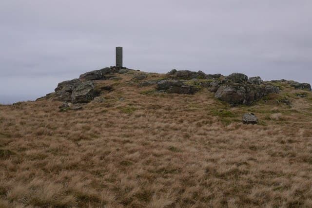
An Cruachan is a conical 435m hill standing between Drynoch and Loch Harport on Skye. Its isolated position gives a far better summit panorama than the height suggests, taking in the full Cuillin skyline.
Quick facts
- Height
- 435m/ 1427ft
- Prominence
- 223 m
- Grid ref
- NG 38177 22503
- Dogs
- Dogs on lead required near livestockDog-friendly guide ↗
Height and prominence cross-checked against the Database of British and Irish Hills (CC BY).
No GPX track yet
Walked this route? Share your track to help other walkers.
Standard route
heather moorland 55% · grass and bracken 30% · rocky summit 15%
A short, sharp ascent from the B8009 near Drynoch, climbing the south-west flank directly. Roughly 4 km return with a steep middle section through heather.
Terrain
Steep, springy heather covers most of the slope, broken by small basalt steps. No path of any kind — pick your line and commit.
In winter
Short enough to remain a winter option in poor conditions on the bigger hills. Wind from Loch Harport hits the conical summit hard.
Best time of year
Getting there
- Glasgow6h 27m
- Edinburgh9h 47m
OS maps: OS Landranger 32, OS Explorer 411
Mobile signal: Poor. Remote island location (Luing/Seil area); limited coverage.
Current conditions
Daylight Today
- Sunrise
- 06:53
- Sunset
- 19:49
- Civil dawn
- 06:14
- Civil dusk
- 20:28
NOAA Solar Calculator · 14 September 2026
Around An Cruachan on the SCOT network
Getting there, basing yourself, and what to do off the hill.
Getting there: Kyle of Lochalsh station
Skye Bridge; Five Sisters of Kintail; Glen Shiel; Plockton
38km from the hill
tripscot.co.uk
On TripSCOTBase yourself in Portree
Main Skye base — Cuillin, Trotternish, Storr
23km from the hill
tripscot.co.uk
On TasteSCOTAfter the hill: Talisker
Carbost on Skye — Cuillin foothills distillery; peppery, maritime, big-bodied
9km from the hill
tastescot.co.uk
An Cruachan — common questions
- How hard is An Cruachan?
- We grade An Cruachan at 1/5, which puts it in easy territory. Underfoot: Steep, springy heather covers most of the slope, broken by small basalt steps.
- What is An Cruachan's prominence?
- 223m of prominence. That's the vertical drop from the summit to the col that links An Cruachan to the next higher ground. That drop is what qualifies it as a Marilyn — a hill with at least 150m of descent on every side.
- When is the best time to climb An Cruachan?
- March, April, May, June, July, August, September, October give the most reliable conditions on An Cruachan. Beyond that window the high ground turns wintry: carry full mountain kit, be confident navigating, and check the SAIS avalanche forecast for the area.
- Is An Cruachan dog-friendly?
- Yes, but dogs must be kept on a lead — there is livestock or ground-nesting bird interest on the route.
- Is there mobile signal on An Cruachan?
- Poor. Remote island location (Luing/Seil area); limited coverage.
- Is An Cruachan safe in winter?
- Short enough to remain a winter option in poor conditions on the bigger hills. Wind from Loch Harport hits the conical summit hard.
Get the OutdoorSCOT weekly
One email a week — new route, hill and bothy guides, seasonal conditions and the odd hard-won lesson. No spam, unsubscribe in one click.