Sub-Marilyn · North-West Highlands
Beinn a' Mhadaidh
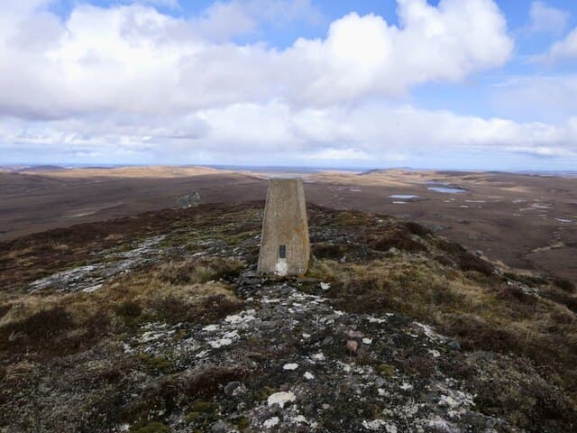
Beinn a' Mhadaidh — "hill of the fox" — is a 403m moorland summit in the NC76 grid square partway up Strath Naver. Cleared townships lie scattered on its lower slopes, a poignant reminder of the Clearances.
Quick facts
- Height
- 403.1m/ 1323ft
- Prominence
- 147 m
- Grid ref
- NC 76898 41490
- Nearest city
- Inverness· 97km
- Dogs
- Dogs on lead required near livestockDog-friendly guide ↗
Sub-Marilyn: 147m of drop — misses the 150m Marilyn cut by 3m. We keep it on the list as a near-miss.
Height and prominence cross-checked against the Database of British and Irish Hills (CC BY).
No GPX track yet
Walked this route? Share your track to help other walkers.
Standard route
heather and bog 65% · grass slopes 25% · rocky summit 10%
Begin at the Strathnaver Museum or further south near Syre, then follow the river-side tracks before climbing the broad eastern shoulder. Allow 4-5 hours.
Terrain
Tussock grass and ankle-deep heather mark the climb. Lower slopes are dotted with the stone footings of cleared crofts — please leave undisturbed.
In winter
Snow rarely accumulates in Strath Naver but the river crossings can become impassable after thaw. Brief winter daylight here barely reaches eight hours in December.
This hill is in the Torridon SAIS forecast area. Check SAIS forecasts in winter (December–April).
Best time of year
Getting there
- Glasgow6h 26m
- Edinburgh7h 38m
OS maps: OS Landranger 10, OS Explorer 448S
Mobile signal: Poor. Strath Halladale / Strath Naver area has virtually no mobile infrastructure.
Current conditions
Daylight Today
- Sunrise
- 05:03
- Sunset
- 21:43
- Civil dawn
- 04:07
- Civil dusk
- 22:39
NOAA Solar Calculator · 30 July 2026
Around Beinn a' Mhadaidh on the SCOT network
Getting there, basing yourself, and what to do off the hill.
Beinn a' Mhadaidh — common questions
- Is Beinn a' Mhadaidh a hard climb?
- Beinn a' Mhadaidh is rated 1/5 (easy) on the OutdoorSCOT scale. Underfoot: Tussock grass and ankle-deep heather mark the climb.
- What is Beinn a' Mhadaidh's prominence?
- 147m of prominence. That's the vertical drop from the summit to the col that links Beinn a' Mhadaidh to the next higher ground. That leaves it 3m short of the 150m drop a Marilyn needs — DoBIH classes it a sub-Marilyn, a near-miss rather than a full Marilyn.
- When is the best time to climb Beinn a' Mhadaidh?
- March, April, May, June, July, August, September, October give the most reliable conditions on Beinn a' Mhadaidh. Beyond that window the high ground turns wintry: carry full mountain kit, be confident navigating, and check the SAIS avalanche forecast for the area.
- Is Beinn a' Mhadaidh dog-friendly?
- Yes, but dogs must be kept on a lead — there is livestock or ground-nesting bird interest on the route.
- Is there mobile signal on Beinn a' Mhadaidh?
- Poor. Strath Halladale / Strath Naver area has virtually no mobile infrastructure.
- Is Beinn a' Mhadaidh safe in winter?
- Snow rarely accumulates in Strath Naver but the river crossings can become impassable after thaw. Brief winter daylight here barely reaches eight hours in December.
Get the OutdoorSCOT weekly
One email a week — new route, hill and bothy guides, seasonal conditions and the odd hard-won lesson. No spam, unsubscribe in one click.