Donald · Borders
Garelet Dod
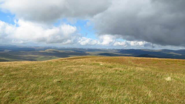
Garelet Dod is one of the quiet middle hills of the Moffat group, a satellite summit lying between Hart Fell and the Tweedhope Sike. A "dod" in Borders Scots is a rounded hump, and the name fits — there is nothing dramatic about the top, just a swelling in the moor.
Quick facts
- Height
- 698m/ 2290ft
- Prominence
- 126 m
- Distance
- 13 km
- Ascent
- 572 m
- Time
- 3–6 hrs
- Grid ref
- NT125172
- Parking
- NT127163
- Nearest city
- Dumfries· 44km
- Dogs
- Dogs on lead required near livestockDog-friendly guide ↗
Height and prominence cross-checked against the Database of British and Irish Hills (CC BY).
No GPX track yet
Walked this route? Share your track to help other walkers.
Standard route
grass moorland 80% · heather patches 15% · summit area 5%
Reached on a Moffat ridge round from the Devil's Beef Tub lay-by, taking in Hart Fell and Whitehope Heights before swinging east to claim the Dod. The shortest line climbs the burn from Capplegill but is unpathed throughout.
Terrain
Pillowy moss and bog cotton along the watershed; the going can be slow when wet. There is no path and no cairn — purely a tick top, but a peaceful one.
In winter
Hard frost transforms the spongy approach into ideal walking. The featureless top can be confusing under a centimetre of snow; pick a bearing off the fence post you last saw and trust the compass.
Best time of year
Getting there
- Glasgow2h 42m
- Edinburgh1h 23m
OS maps: OS Landranger 78
Mobile signal: Strong summit reception; EE behaves well. Smooth Moffat Hills satellite summit.
Current conditions
Daylight Today
- Sunrise
- 04:55
- Sunset
- 21:45
- Civil dawn
- 04:01
- Civil dusk
- 22:38
NOAA Solar Calculator · 17 July 2026
Around Garelet Dod on the SCOT network
Getting there, basing yourself, and what to do off the hill.
Garelet Dod — common questions
- What difficulty is Garelet Dod?
- On the OutdoorSCOT scale, Garelet Dod comes in at 3/5 — moderately challenging. Expect roughly 13km and 572m of ascent on the usual route — 3-6 hours for most parties. Terrain: Pillowy moss and bog cotton along the watershed; the going can be slow when wet.
- How prominent is Garelet Dod?
- Garelet Dod has 126m of topographic prominence — the height of its summit above the highest col connecting it to higher ground.
- Where should I park to climb Garelet Dod?
- Standard parking is at NT127163. Check the parking grid reference on an OS map before travel; informal laybys can fill on summer weekends.
- When should I climb Garelet Dod?
- The standard good-weather months for Garelet Dod are March, April, May, June, July, August, September, October, November. Outside those months, expect winter conditions on the high ground — full mountain kit, navigation skills, and a check of the SAIS avalanche forecast for the relevant region.
- Can I bring my dog up Garelet Dod?
- On a lead only — the route crosses ground with livestock or nesting-bird interest.
- What's mobile reception like on Garelet Dod?
- Strong summit reception; EE behaves well. Smooth Moffat Hills satellite summit.
- Is Garelet Dod safe in winter?
- Hard frost transforms the spongy approach into ideal walking. The featureless top can be confusing under a centimetre of snow; pick a bearing off the fence post you last saw and trust the compass.
Get the OutdoorSCOT weekly
One email a week — new route, hill and bothy guides, seasonal conditions and the odd hard-won lesson. No spam, unsubscribe in one click.