Marilyn · Glen Coe & Lochaber
Meall a' Bhainne
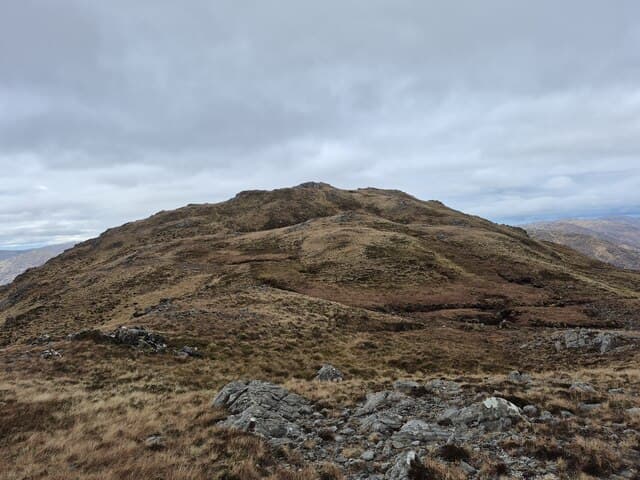
Meall a' Bhainne — the Milky Hill — is a 559m grassy summit between the Cona Glen and Loch Linnhe in north Ardgour. The name probably refers to milky waterfalls on its eastern flank. From the top there is a fine outlook across Loch Linnhe to the Mamores and Glencoe.
Quick facts
- Height
- 559m/ 1834ft
- Prominence
- 204 m
- Grid ref
- NM 90155 78507
- Nearest city
- Fort William· 21km
- Dogs
- Dogs on lead required near livestockDog-friendly guide ↗
Height and prominence cross-checked against the Database of British and Irish Hills (CC BY).
No GPX track yet
Walked this route? Share your track to help other walkers.
Standard route
heather moorland 45% · rough grassland 35% · rocky summit 20%
Use the estate track up Cona Glen, leaving it at a suitable burn to climb steep grass and bracken east onto the broad summit. The summit is featureless but the views eastward are excellent. Five hours including the walk in.
Terrain
Tussock grass and bracken on the lower slopes, then short turf and peat on the summit dome. Cona Glen track is well-maintained for the walk-in. Few rocks until the cap.
In winter
Holds snow on its rounded summit but rarely in significant quantity. The walk in along Cona Glen is exposed to easterly winds funnelling off Loch Linnhe — wind chill is the main concern.
This hill is in the Glen Coe SAIS forecast area. Check SAIS forecasts in winter (December–April).
Best time of year
Getting there
- Glasgow4h 0m
- Edinburgh6h 17m
OS maps: OS Landranger 40, OS Explorer 391
Mobile signal: Poor. Ardgour/Sunart; very limited coverage.
Current conditions
Daylight Today
- Sunrise
- 05:17
- Sunset
- 21:40
- Civil dawn
- 04:26
- Civil dusk
- 22:31
NOAA Solar Calculator · 30 July 2026
Around Meall a' Bhainne on the SCOT network
Getting there, basing yourself, and what to do off the hill.
Base yourself in Fort William
Ben Nevis base, West Highland Line, gateway to Lochaber
21km from the hill
tripscot.co.uk
On TasteSCOTAfter the hill: Ben Nevis Distillery
Fort William — Lochaber distillery at the foot of the Ben; long-aged Japanese-owned classics
22km from the hill
tastescot.co.uk
Meall a' Bhainne — common questions
- Is Meall a' Bhainne a hard climb?
- Meall a' Bhainne is rated 2/5 (moderate) on the OutdoorSCOT scale. Underfoot: Tussock grass and bracken on the lower slopes, then short turf and peat on the summit dome.
- What is Meall a' Bhainne's prominence?
- 204m of prominence. That's the vertical drop from the summit to the col that links Meall a' Bhainne to the next higher ground. That drop is what qualifies it as a Marilyn — a hill with at least 150m of descent on every side.
- When is the best time to climb Meall a' Bhainne?
- March, April, May, June, July, August, September, October give the most reliable conditions on Meall a' Bhainne. Beyond that window the high ground turns wintry: carry full mountain kit, be confident navigating, and check the SAIS avalanche forecast for the area.
- Is Meall a' Bhainne dog-friendly?
- Yes, but dogs must be kept on a lead — there is livestock or ground-nesting bird interest on the route.
- Is there mobile signal on Meall a' Bhainne?
- Poor. Ardgour/Sunart; very limited coverage.
- Is Meall a' Bhainne safe in winter?
- Holds snow on its rounded summit but rarely in significant quantity. The walk in along Cona Glen is exposed to easterly winds funnelling off Loch Linnhe — wind chill is the main concern.
Get the OutdoorSCOT weekly
One email a week — new route, hill and bothy guides, seasonal conditions and the odd hard-won lesson. No spam, unsubscribe in one click.