Long distance
Speyside Way
Follows the River Spey from the Moray Firth coast into the Cairngorms, passing through the heart of Scotch whisky country. Best walked best north-to-south over 5 days. The full route covers 105 km (65 mi) with 1,100 m of climbing — an accessible introduction to long-distance walking.
Quick facts
- Distance
- 105 km/ 65 mi
- Typical days
- 5
- Total ascent
- 1100 m
- Difficulty
- easy
- Start → Finish
- Buckie → Aviemore
- Best direction
- North to South
- Water sources
- Buckie, Fochabers, Aberlour, Craigellachie, Grantown-on-Spey and Aviemore have tap water and shops. The route follows the River Spey for much of its length — water is everywhere but treat before drinking. Distillery cafes and pubs in Speyside whisky country offer refills.
- Mobile signal
- EE/Vodafone strong along the populated Spey valley. Coverage continuous at all overnight towns and at most distillery visitor centres. Brief patches on the moorland between Boat of Garten and Aviemore.
✔ Waymarked throughout
Approximate profile derived from per-stage ascent — accurate on total climb and pattern, not a pixel-precise GPX trace.
Our take
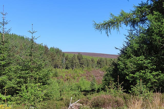
The Speyside Way is a walker's Scotch whisky tour. Low-level, easy terrain, and a distillery or three on the route every day. The Glenlivet-to-Aviemore southern section gets quietly spectacular as you enter the Cairngorms. A brilliant first long-distance walk that happens to involve a lot of drams.
Highlights
- Distillery visits at Aberlour, Glenlivet, Cardhu
- The Aberlour suspension bridge
- Grantown-on-Spey
- The southern approach into Aviemore
Mid-route waypoints
Navigation by progression marker rather than total distance.
| km | Waypoint | Type |
|---|---|---|
| 0 km | Buckie (Cluny Square)Coastal start; Moray Firth fishing town | start |
| 13 km | Spey BayMouth of the River Spey; Scottish Dolphin Centre | water |
| 21 km | FochabersGeorgian village with Baxters Highland Village nearby | village |
| 42 km | CraigellachieTelford's iron bridge over the Spey; Speyside Cooperage | bridge |
| 48 km | AberlourWhisky village; Walkers shortbread and Aberlour Distillery | village |
| 65 km | BallindallochOld railway station and castle; junction with Tomintoul Spur | station |
| 92 km | Grantown-on-SpeyHighland resort town with Smokehouse and full services | village |
| 110 km | Boat of GartenStrathspey Steam Railway and osprey viewpoint nearby | station |
| 130 km | AviemoreTrail finish at the edge of the Cairngorms National Park | finish |
Day-by-day itinerary
A suggested 5-day schedule. Adjust to your fitness and conditions.
1Buckie to Fochabers18km · 150m ascent
Coastal walking from Buckie harbour past Portgordon to Spey Bay, then up the river to the Georgian town of Fochabers. The route follows old railway lines, riverside paths and the Spey itself through farmland and pine forest; gradients are gentle and it suits first-time long-distance walkers happy to detour into distilleries each afternoon.
- Terrain
- Coastal paths, riverside tracks, quiet lanes. Flat and easy.
- Overnight
- Fochabers has hotels and B&Bs. Gordon Arms is a good choice.
- Stats
- Buckie → Fochabers · 18km · ↑150m
2Fochabers to Craigellachie22km · 200m ascent
Follow the Spey through woodland and past Aberlour, the heart of whisky country. Distillery visits at Aberlour and Craigellachie are tempting diversions.
- Terrain
- Riverside paths, disused railway, woodland tracks.
- Overnight
- Craigellachie has the Craigellachie Hotel and the Highlander Inn. Aberlour B&Bs also available.
- Stats
- Fochabers → Craigellachie · 22km · ↑200m
3Craigellachie to Ballindalloch20km · 200m ascent
Past Cardhu and Knockando distilleries along the Speyside railway line. The valley widens and the Cairngorm foothills appear ahead.
- Terrain
- Disused railway trackbed, riverside paths. Flat and well-surfaced.
- Overnight
- Ballindalloch has the Delnashaugh Inn and B&Bs. Ballindalloch Castle is nearby.
- Stats
- Craigellachie → Ballindalloch · 20km · ↑200m
4Ballindalloch to Grantown-on-Spey24km · 250m ascent
Through the Cromdale Hills spur or along the river to the handsome planned town of Grantown-on-Spey. Glenlivet distillery is a detour option.
- Terrain
- Hill paths on the spur route, or riverside tracks on the low route.
- Overnight
- Grantown-on-Spey has several hotels, B&Bs and hostels. Good resupply stop.
- Stats
- Ballindalloch → Grantown-on-Spey · 24km · ↑250m
5Grantown-on-Spey to Aviemore21km · 300m ascent
The final stretch follows the Spey into the Cairngorms National Park. Ancient Caledonian pine forest at Abernethy and the Cairngorms backdrop make a fine finish.
- Terrain
- Riverside paths, forest trails, some hill tracks. Gentle gradients.
- Overnight
- Aviemore has everything — hotels, hostels, restaurants and outdoor shops.
- Stats
- Grantown-on-Spey → Aviemore · 21km · ↑300m
Transport
To start (Buckie)
Train · ScotRail
Aberdeen / Inverness to Elgin (nearest mainline station to Buckie)
Roughly hourly
Check times & book →Bus · Stagecoach North Scotland 35 / X35
Elgin / Aberdeen to Buckie
Roughly hourly
Check times & book →
From finish (Aviemore)
Train · ScotRail Highland Main Line
Aviemore to Inverness / Perth / Edinburgh / Glasgow
Roughly hourly to Inverness
Check times & book →Bus · Scottish Citylink M90 / G10
Aviemore to Inverness / Edinburgh / Glasgow
Several daily
Check times & book →
Best months
Accommodation
Well-served by hotels and B&Bs. Pre-book whisky tastings separately. Hotels and B&Bs in every village along the route; book whisky-themed tours separately as distilleries fill up months ahead in summer. Wild camping is fine away from villages and farmland.
Night-by-night guide: where to stay →Resupply
Plentiful. Aberlour, Craigellachie, Grantown-on-Spey, Aviemore all have shops and pubs. The longest no-shop stretch is about 15km between Ballindalloch and Grantown; carry lunch each day. Postal drops to hotels in Grantown work well for whisky purchases you want to bring home.
Connect with
Chain into a longer expedition by combining with adjacent long-distance routes.
Speyside Way + Dava Way
Connects at Grantown-on-Spey
Walk north from Grantown on the Dava Way to Forres for a two-day extension into Moray.
Speyside Way + Moray Coast Trail
Connects at Spey Bay / Buckie (north end of Speyside Way)
Continue east or west along the Moray Coast Trail from the Speyside Way finish. Together they make a Strath to Coast traverse.
Speyside Way + East Highland Way
Connects at Aviemore (Speyside Way south end)
Walk west from Aviemore on the East Highland Way to Fort William, then south on the WHW — a coast-to-coast Highland traverse.
Current conditions
Weather at the start point (Buckie)
Daylight Today
- Sunrise
- 04:31
- Sunset
- 22:04
- Civil dawn
- 03:27
- Civil dusk
- 23:08
NOAA Solar Calculator · 13 July 2026
Share your experience
Walked the Speyside Way? Help others plan their trip.
Getting to and from the Speyside Way
Train and town anchors at each end of the route — on TripSCOT.