Long distance
Moray Coast Trail
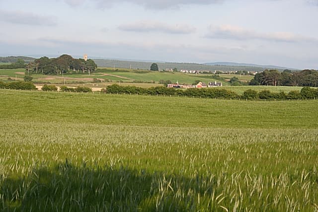
Follows the Moray Firth coast from Forres to Cullen past fishing villages, dramatic cliffs, dolphins and long sandy beaches. The sunniest and driest walking in Scotland. Best walked best west-to-east with the prevailing weather behind you over 5 days. The full route covers 80 km (50 mi) with 1,100 m of climbing — an accessible introduction to long-distance walking.
Quick facts
- Distance
- 80 km/ 50 mi
- Typical days
- 5
- Total ascent
- 1100 m
- Difficulty
- easy
- Start → Finish
- Forres → Cullen
- Best direction
- West to East
- Water sources
- Forres, Findhorn, Burghead, Lossiemouth, Hopeman, Cullen — all have taps, shops and cafes. The route stays on the populated coast throughout. Continuous water access; never more than 4km from a refill.
- Mobile signal
- EE/Vodafone strong along the Moray coast — continuous coverage. The brief inland sections (across the firth estuaries, behind dunes) may drop signal briefly. Generally excellent reception.
✔ Waymarked throughout
Approximate profile derived from per-stage ascent — accurate on total climb and pattern, not a pixel-precise GPX trace.
Our take
The Moray Coast Trail sits in the rain shadow of the Highlands and enjoys the best weather in Scotland — averaging 30% less rainfall than the west coast. The walking is gentle and the fishing villages (Findhorn, Burghead, Lossiemouth, Buckie, Cullen) are genuinely charming. Dolphins are regularly spotted from Chanonry Point. Cullen skink at the finish is mandatory.
Highlights
- Findhorn Bay and its community
- Dolphin spotting near Lossiemouth
- Bow Fiddle Rock at Portknockie
- Cullen viaduct and harbour
Day-by-day itinerary
A suggested 5-day schedule. Adjust to your fitness and conditions.
1Forres to Findhorn12km · 100m ascent
A short opening day from the market town of Forres to the coastal village of Findhorn and its famous spiritual community on the bay.
- Terrain
- Woodland paths, coastal tracks. Flat and easy.
- Overnight
- Findhorn has B&Bs and the Findhorn Foundation. Camping at the caravan park.
- Stats
- Forres → Findhorn · 12km · ↑100m
2Findhorn to Lossiemouth18km · 200m ascent
Along the coast past Burghead — an ancient Pictish fort — and Hopeman to the seaside town of Lossiemouth with its long sandy beaches.
- Terrain
- Coastal paths, beach walking, cliff-top sections.
- Overnight
- Lossiemouth has hotels, B&Bs and caravan parks. Two excellent beaches.
- Stats
- Findhorn → Lossiemouth · 18km · ↑200m
3Lossiemouth to Buckie20km · 300m ascent
Past Kingston and Garmouth to Spey Bay, where the Spey meets the sea, then along the coast to the fishing town of Buckie.
- Terrain
- Beach walking, coastal paths, harbour walking.
- Overnight
- Buckie has hotels and B&Bs. The harbour area is atmospheric.
- Stats
- Lossiemouth → Buckie · 20km · ↑300m
4Buckie to Portknockie14km · 250m ascent
Along the dramatic coastline past Findochty harbour to Portknockie and the iconic Bow Fiddle Rock sea arch.
- Terrain
- Cliff-top paths, harbour walks, some steep sections.
- Overnight
- Portknockie has B&Bs. Findochty and Cullen are close alternatives.
- Stats
- Buckie → Portknockie · 14km · ↑250m
5Portknockie to Cullen16km · 250m ascent
The final stretch past the viaduct arches at Cullen to the harbour. Finish with a bowl of Cullen skink — the famous smoked haddock soup from this very town.
- Terrain
- Cliff paths, beach sections, harbour walking.
- Overnight
- Cullen has the Cullen Bay Hotel and B&Bs. Seafood restaurants celebrate the finish.
- Stats
- Portknockie → Cullen · 16km · ↑250m
Transport
To start (Forres)
Train · ScotRail + Stagecoach North Scotland (32)
Aberdeen / Inverness to Forres (ScotRail), then Stagecoach 32 to Findhorn
Hourly trains to Forres; bus 5–6×/day Mon–Sat
Findhorn bus service was reinstated as off-peak only in 2024.
Check times & book →
From finish (Cullen)
Bus · Stagecoach Bluebird (35)
Cullen to Elgin (~1h10) or Aberdeen (~2h40)
Hourly, 7 days a week
Elgin and Aberdeen both have direct ScotRail services to Inverness / Edinburgh / Glasgow.
Check times & book →
Best months
Accommodation
B&Bs and hotels at Findhorn, Lossiemouth, Buckie and Cullen. Well-served throughout. B&Bs and small hotels in Findhorn, Lossiemouth, Buckie and Cullen; the route is well-served throughout. Caravan parks at Findhorn and Lossiemouth take touring tents.
Night-by-night guide: where to stay →Resupply
Shops in every coastal town. No remote sections. Easy daily resupply. Co-op or small Tesco branches in every coastal town along the route; longest gap is under 8km and cafes and chippies are everywhere. Easiest resupply of any Scottish trail.
Connect with
Chain into a longer expedition by combining with adjacent long-distance routes.
Moray Coast Trail + Dava Way
Connects at Forres (south end of Moray Coast Trail)
Walk the coast from Findhorn or Cullen into Forres, then south on the Dava Way to Grantown — about 60km of combined coast and moor.
Moray Coast Trail + Speyside Way
Connects at Spey Bay / Buckie
Continue south from Spey Bay on the Speyside Way for a full Moray-Strathspey traverse. Combined ~150km.
Current conditions
Weather at the start point (Forres)
Daylight Today
- Sunrise
- 05:05
- Sunset
- 21:37
- Civil dawn
- 04:12
- Civil dusk
- 22:30
NOAA Solar Calculator · 30 July 2026
Share your experience
Walked the Moray Coast Trail? Help others plan their trip.