Marilyn · Ochils
Torlum
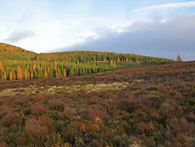
Torlum is the wooded knoll at the south-west end of the Ochils, rising to 393m at NN 819 192 directly above the village of Tillicoultry. Its name probably derives from the Gaelic torr lom, "bare hillock". The summit, planted in conifers on its upper flanks, gives an unexpectedly wide view from Stirling Castle along the Forth to Bass Rock.
Quick facts
- Height
- 393.7m/ 1292ft
- Prominence
- 233 m
- Grid ref
- NN 81907 19222
- Nearest city
- Stirling· 26km
- Dogs
- Dogs on lead required near livestockDog-friendly guide ↗
Height and prominence cross-checked against the Database of British and Irish Hills (CC BY).
No GPX track yet
Walked this route? Share your track to help other walkers.
Standard route
heather moorland 70% · grass slopes 20% · rocky outcrops 10%
A short hill day from the Mill Glen car park at Tillicoultry: head up the spectacular gorge path past the Daiglen Burn, then break west off the Glen Quey track and follow a forest break up onto Torlum's grassy summit dome — under 5km round trip.
Terrain
Steep gravel and rock steps in the Mill Glen lower path, then mature spruce plantation and short turf on the dome. Forestry rides can be muddy after rain but the upper slopes are well-drained.
In winter
Below 400m here, expect verglas on the bedrock paths through the gorge after a freeze — that is the principal cold-month hazard. Snow on the top rarely lies more than a few days, but ice on the Daiglen path makes microspikes worthwhile.
Best time of year
Getting there
- Glasgow2h 32m
- Edinburgh2h 8m
OS maps: OS Landranger 57, OS Explorer 047E, OS Explorer 368E
Mobile signal: Poor. Remote Perthshire hill; limited coverage.
Current conditions
Daylight Today
- Sunrise
- 05:14
- Sunset
- 21:31
- Civil dawn
- 04:23
- Civil dusk
- 22:21
NOAA Solar Calculator · 30 July 2026
Around Torlum on the SCOT network
Getting there, basing yourself, and what to do off the hill.
Getting there: Gleneagles station
Glen Devon; Ochil ridges; Auchterarder; PGA Centenary course access
13km from the hill
tripscot.co.uk
On TripSCOTBase yourself in Callander
Trossachs gateway — Ben Ledi, Stuc a Chroin, Rob Roy Way
22km from the hill
tripscot.co.uk
On TasteSCOTAfter the hill: The Glenturret
Crieff — Scotland's oldest working distillery; Famous Grouse Experience
5km from the hill
tastescot.co.uk
Torlum — common questions
- How hard is Torlum?
- We grade Torlum at 1/5, which puts it in easy territory. Terrain: Steep gravel and rock steps in the Mill Glen lower path, then mature spruce plantation and short turf on the dome.
- How prominent is Torlum?
- Torlum has 233m of topographic prominence — the height of its summit above the highest col connecting it to higher ground. Marilyns are defined by that measure: at least 150m of drop on all sides.
- When should I climb Torlum?
- The standard good-weather months for Torlum are March, April, May, June, July, August, September, October. Outside those months, expect winter conditions on the high ground — full mountain kit, navigation skills, and a check of the SAIS avalanche forecast for the relevant region.
- Can I bring my dog up Torlum?
- On a lead only — the route crosses ground with livestock or nesting-bird interest.
- What's mobile reception like on Torlum?
- Poor. Remote Perthshire hill; limited coverage.
- Is Torlum safe in winter?
- Below 400m here, expect verglas on the bedrock paths through the gorge after a freeze — that is the principal cold-month hazard. Snow on the top rarely lies more than a few days, but ice on the Daiglen path makes microspikes worthwhile.
Get the OutdoorSCOT weekly
One email a week — new route, hill and bothy guides, seasonal conditions and the odd hard-won lesson. No spam, unsubscribe in one click.