Marilyn · Perthshire
The Fruin
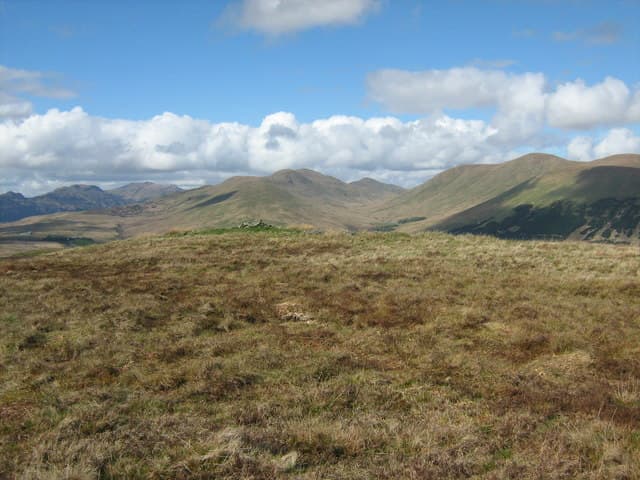
The Fruin is the broad 361m hill that gives its name to Glen Fruin, scene of the 1603 clan battle between MacGregors and Colquhouns. The summit at NS 276 872 sits on the watershed between Glen Fruin and the Vale of Leven, with grand views south to the Firth of Clyde and east across the lower reach of Loch Lomond.
Quick facts
- Height
- 361m/ 1184ft
- Prominence
- 168 m
- Grid ref
- NS 27626 87220
- Nearest city
- Glasgow· 38km
- Dogs
- Dogs on lead required near livestockDog-friendly guide ↗
Height and prominence cross-checked against the Database of British and Irish Hills (CC BY).
No GPX track yet
Walked this route? Share your track to help other walkers.
Standard route
grass and bracken 55% · heather moorland 35% · summit area 10%
The cleanest line starts from the public road through Glen Fruin near Auchenheglish, climbing pathless grass and rush onto the south-east ridge. A clear quad track helps in the middle section before fading on the open summit dome.
Terrain
Sheep-cropped grass and rush throughout — fast going underfoot apart from a few boggy hollows near the burns. Two crossings of fence lines via stiles. No exposure anywhere on the hill.
In winter
A low rolling hill where deep snow is rare; the grass freezes hard in cold easterlies, making for fast going. The main winter concern is hidden mud-and-ice in the field gateways near the road.
Best time of year
Getting there
- Glasgow1h 25m
- Edinburgh4h 5m
OS maps: OS Landranger 56, OS Explorer 0038, OS Explorer 347
Mobile signal: Reliable up top; EE holds throughout. Views across the Vale of Leven.
Current conditions
Daylight Today
- Sunrise
- 05:19
- Sunset
- 21:32
- Civil dawn
- 04:29
- Civil dusk
- 22:22
NOAA Solar Calculator · 30 July 2026
Around The Fruin on the SCOT network
Getting there, basing yourself, and what to do off the hill.
The Fruin — common questions
- What difficulty is The Fruin?
- On the OutdoorSCOT scale, The Fruin comes in at 1/5 — easy. Ground conditions: Sheep-cropped grass and rush throughout — fast going underfoot apart from a few boggy hollows near the burns.
- How much drop does The Fruin have?
- The drop is 168m: measured from the summit of The Fruin down to the saddle joining it to higher terrain. Passing the 150m-drop threshold on all sides is exactly what makes it a Marilyn.
- What's the best month to climb The Fruin?
- Aim for March, April, May, June, July, August, September, October on The Fruin. In the remaining months treat it as a winter hill — full kit, solid navigation, and a look at the relevant SAIS avalanche forecast before you go.
- Can dogs go up The Fruin?
- Dogs are fine on a lead. The route passes livestock or ground-nesting bird habitat, so keep them close throughout.
- Will I get phone signal on The Fruin?
- Reliable up top; EE holds throughout. Views across the Vale of Leven.
- Is The Fruin safe in winter?
- A low rolling hill where deep snow is rare; the grass freezes hard in cold easterlies, making for fast going. The main winter concern is hidden mud-and-ice in the field gateways near the road.
Get the OutdoorSCOT weekly
One email a week — new route, hill and bothy guides, seasonal conditions and the odd hard-won lesson. No spam, unsubscribe in one click.