Sub-Marilyn · Galloway
Shaw Hill
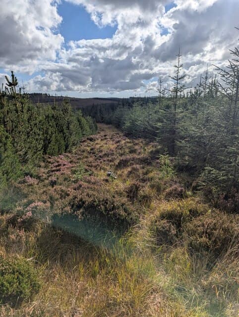
A 383m moorland top at NX 59 east of New Galloway above the Water of Ken. Shaw Hill sits on the quieter eastern fringe of the Galloway Forest with views over the Ken valley to Cairnsmore of Carsphairn.
Quick facts
- Height
- 383m/ 1257ft
- Prominence
- 146 m
- Grid ref
- NX 59059 71862
- Nearest city
- Dumfries· 39km
- Dogs
- Dogs on lead required near livestockDog-friendly guide ↗
Sub-Marilyn: 146m of drop — misses the 150m Marilyn cut by 4m. We keep it on the list as a near-miss.
Height and prominence cross-checked against the Database of British and Irish Hills (CC BY).
No GPX track yet
Walked this route? Share your track to help other walkers.
Standard route
heather moorland 65% · boggy ground 20% · grassy summit 15%
From the B7000 near Mossdale, follow farm tracks east and then strike onto open heather for the final pull to the summit. About 2 hours round trip.
Terrain
Farm tracks then rough heather and grass. No paths on the summit dome.
In winter
Low elevation and inland position make for cold but largely snow-free conditions. Boggy ground firms up in frost and walking is much faster.
Best time of year
Getting there
- Glasgow2h 10m
- Edinburgh4h 33m
OS maps: OS Landranger 77, OS Explorer 319
Mobile signal: Poor. Nothing dependable; EE gives out in the Galloway Forest interior.
Current conditions
Daylight Today
- Sunrise
- 06:47
- Sunset
- 19:38
- Civil dawn
- 06:10
- Civil dusk
- 20:15
NOAA Solar Calculator · 14 September 2026
Around Shaw Hill on the SCOT network
Getting there, basing yourself, and what to do off the hill.
Getting there: Ayr station
Ayrshire coast; Galloway approach via bus/car
56km from the hill
tripscot.co.uk
On TripSCOTBase yourself in Kirkcudbright
Galloway base — Solway coast, Galloway Forest, Mull of Galloway Trail
23km from the hill
tripscot.co.uk
On TasteSCOTAfter the hill: Bladnoch
Wigtown — Galloway's only distillery; Scotland's most southerly
24km from the hill
tastescot.co.uk
Shaw Hill — common questions
- Is Shaw Hill a hard climb?
- Shaw Hill is rated 1/5 (easy) on the OutdoorSCOT scale. Underfoot: Farm tracks then rough heather and grass.
- What is Shaw Hill's prominence?
- 146m of prominence. That's the vertical drop from the summit to the col that links Shaw Hill to the next higher ground. That leaves it 4m short of the 150m drop a Marilyn needs — DoBIH classes it a sub-Marilyn, a near-miss rather than a full Marilyn.
- When is the best time to climb Shaw Hill?
- March, April, May, June, July, August, September, October give the most reliable conditions on Shaw Hill. Beyond that window the high ground turns wintry: carry full mountain kit, be confident navigating, and check the SAIS avalanche forecast for the area.
- Is Shaw Hill dog-friendly?
- Yes, but dogs must be kept on a lead — there is livestock or ground-nesting bird interest on the route.
- Is there mobile signal on Shaw Hill?
- Poor. Nothing dependable; EE gives out in the Galloway Forest interior.
- Is Shaw Hill safe in winter?
- Low elevation and inland position make for cold but largely snow-free conditions. Boggy ground firms up in frost and walking is much faster.
Get the OutdoorSCOT weekly
One email a week — new route, hill and bothy guides, seasonal conditions and the odd hard-won lesson. No spam, unsubscribe in one click.