Marilyn · Galloway
Craignell
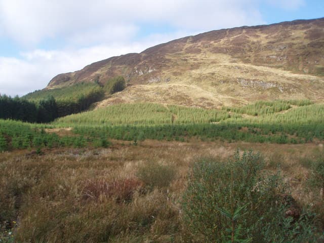
A 477m heather hill at NX 51 west of Clatteringshaws Loch, set among the rolling granite uplands of the Galloway Forest. Craignell looks across Loch Dee to the Awful Hand ridge.
Quick facts
- Height
- 477.5m/ 1567ft
- Prominence
- 228 m
- Grid ref
- NX 51006 75221
- Nearest city
- Dumfries· 46km
- Dogs
- Dogs on lead required near livestockDog-friendly guide ↗
Height and prominence cross-checked against the Database of British and Irish Hills (CC BY).
No GPX track yet
Walked this route? Share your track to help other walkers.
Standard route
heather moorland 65% · boggy ground 20% · grassy summit 15%
From the Bruce's Stone car park follow the Loch Trool road then strike east up open heather to the summit. Trackless after the first kilometre — about 2.5 hours up and down.
Terrain
Open heather and tussock grass with patches of bog between the granite ribs. No path on the upper hill.
In winter
Low altitude keeps snow off most of the year. Wet underfoot conditions are the main concern from November through March.
Best time of year
Getting there
- Glasgow2h 6m
- Edinburgh4h 46m
OS maps: OS Landranger 77, OS Explorer 319
Mobile signal: Poor. No signal on any network. Paper navigation essential.
Current conditions
Daylight Today
- Sunrise
- 05:22
- Sunset
- 21:26
- Civil dawn
- 04:35
- Civil dusk
- 22:13
NOAA Solar Calculator · 30 July 2026
Around Craignell on the SCOT network
Getting there, basing yourself, and what to do off the hill.
Getting there: Ayr station
Ayrshire coast; Galloway approach via bus/car
50km from the hill
tripscot.co.uk
On TripSCOTBase yourself in Kirkcudbright
Galloway base — Solway coast, Galloway Forest, Mull of Galloway Trail
30km from the hill
tripscot.co.uk
On TasteSCOTAfter the hill: Bladnoch
Wigtown — Galloway's only distillery; Scotland's most southerly
23km from the hill
tastescot.co.uk
Craignell — common questions
- How hard is Craignell?
- We grade Craignell at 1/5, which puts it in easy territory. Underfoot: Open heather and tussock grass with patches of bog between the granite ribs.
- What is Craignell's prominence?
- 228m of prominence. That's the vertical drop from the summit to the col that links Craignell to the next higher ground. That drop is what qualifies it as a Marilyn — a hill with at least 150m of descent on every side.
- When is the best time to climb Craignell?
- March, April, May, June, July, August, September, October give the most reliable conditions on Craignell. Beyond that window the high ground turns wintry: carry full mountain kit, be confident navigating, and check the SAIS avalanche forecast for the area.
- Is Craignell dog-friendly?
- Yes, but dogs must be kept on a lead — there is livestock or ground-nesting bird interest on the route.
- Is there mobile signal on Craignell?
- Poor. No signal on any network. Paper navigation essential.
- Is Craignell safe in winter?
- Low altitude keeps snow off most of the year. Wet underfoot conditions are the main concern from November through March.
Get the OutdoorSCOT weekly
One email a week — new route, hill and bothy guides, seasonal conditions and the odd hard-won lesson. No spam, unsubscribe in one click.