Marilyn · Orkney & Shetland
Scalla Field
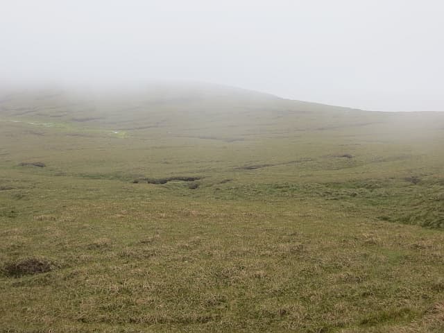
Scalla Field is the highest point in the central interior of Shetland Mainland, a 281m peat plateau north of Weisdale Voe. The hill is a real backwater — few walkers come here outside of dedicated Marilyn rounds — but the silence and open sky are part of the appeal.
Quick facts
- Height
- 281m/ 922ft
- Prominence
- 267 m
- Grid ref
- HU 38929 57246
- Dogs
- Dogs on lead required near livestockDog-friendly guide ↗
Height and prominence cross-checked against the Database of British and Irish Hills (CC BY).
No GPX track yet
Walked this route? Share your track to help other walkers.
Standard route
blanket bog 55% · heather moorland 30% · rocky summit 15%
A pathless walk up from the minor road near Petta Dale, crossing peat moor and avoiding the worst of the bog. Around 6-7km return with 200m of ascent, taking 3 hours due to the difficult ground.
Terrain
Some of the wettest walking in Shetland — peat hags, groughs and standing water are normal. A dry summer or hard frost transforms the experience.
In winter
Frozen ground makes winter perversely the best season here. Snow rarely deep but the wind across the open plateau is biting.
Best time of year
Getting there
- Glasgow14h 48m
- Edinburgh12h 16m
Ferry access
Aberdeen → Lerwick (Shetland)
- Crossing time720 min
- Summer sailingsDaily overnight sailing (Apr–Oct)
- Winter sailingsDaily overnight sailing (Nov–Mar)
- Book ahead14 days
A 12-hour overnight sailing — book a cabin berth. Plan a multi-day Shetland trip; the island is large and the journey is substantial. Flights from Aberdeen/Edinburgh are a faster alternative.
Book on ferry operator ↗OS maps: OS Landranger 2, OS Landranger 3, OS Explorer 467E
Mobile signal: Poor. Central Shetland interior; EE fails. Lerwick is the nearest coverage.
Current conditions
Daylight Today
- Sunrise
- 04:39
- Sunset
- 21:45
- Civil dawn
- 03:35
- Civil dusk
- 22:48
NOAA Solar Calculator · 30 July 2026
Scalla Field — common questions
- Is Scalla Field a hard climb?
- Scalla Field is rated 2/5 (moderate) on the OutdoorSCOT scale. Underfoot: Some of the wettest walking in Shetland — peat hags, groughs and standing water are normal.
- What is Scalla Field's prominence?
- 267m of prominence. That's the vertical drop from the summit to the col that links Scalla Field to the next higher ground. That drop is what qualifies it as a Marilyn — a hill with at least 150m of descent on every side.
- When is the best time to climb Scalla Field?
- March, April, May, June, July, August, September, October give the most reliable conditions on Scalla Field. Beyond that window the high ground turns wintry: carry full mountain kit, be confident navigating, and check the SAIS avalanche forecast for the area.
- Is Scalla Field dog-friendly?
- Yes, but dogs must be kept on a lead — there is livestock or ground-nesting bird interest on the route.
- Is there mobile signal on Scalla Field?
- Poor. Central Shetland interior; EE fails. Lerwick is the nearest coverage.
- How do I get the ferry to Scalla Field?
- Aberdeen → Lerwick (Shetland). Daily overnight sailing (Apr–Oct) in summer; Daily overnight sailing (Nov–Mar) in winter. Book at least 14 days ahead. A 12-hour overnight sailing — book a cabin berth. Plan a multi-day Shetland trip; the island is large and the journey is substantial. Flights from Aberdeen/Edinburgh are a faster alternative.
- Is Scalla Field safe in winter?
- Frozen ground makes winter perversely the best season here. Snow rarely deep but the wind across the open plateau is biting.
Get the OutdoorSCOT weekly
One email a week — new route, hill and bothy guides, seasonal conditions and the odd hard-won lesson. No spam, unsubscribe in one click.