Marilyn · Borders
Scald Law
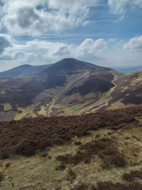
At 579m, Scald Law is the highest summit in the Pentland Hills — the NT-prefix range that forms Edinburgh's southern skyline. Despite its low altitude, the steep flanks above Loganlea and the Howe give it a properly mountain-shaped feel.
Quick facts
- Height
- 579m/ 1900ft
- Prominence
- 314 m
- Grid ref
- NT 19169 61080
- Nearest city
- Edinburgh· 15km
- Dogs
- Dogs on lead required near livestockDog-friendly guide ↗
Height and prominence cross-checked against the Database of British and Irish Hills (CC BY).
No GPX track yet
Walked this route? Share your track to help other walkers.
Standard route
grass moorland 60% · heather 25% · rocky summit 15%
A direct ascent from the Nine Mile Burn or via the Howe car park onto the main Pentlands ridge, then over Carnethy and East/West Kip if doing the classic five-hill round. Allow 4-5 hours for the full traverse.
Terrain
Well-trodden Pentlands paths over short cropped grass, with steep grassy steps between summits on the ridge and stony patches near the cairn.
In winter
Snow can sit on Scald Law for weeks in a cold spell, and the steep north-facing slopes hold firm neve — micro-spikes useful, occasionally an axe. Wind exposure on the ridge is the main hazard.
Best time of year
Getting there
- Glasgow2h 28m
- Edinburgh0h 23m
OS maps: OS Landranger 65, OS Landranger 66, OS Explorer 344
Mobile signal: Good. Pentland Hills; EE reliable on summit.
Current conditions
Daylight Today
- Sunrise
- 06:42
- Sunset
- 19:36
- Civil dawn
- 06:05
- Civil dusk
- 20:13
NOAA Solar Calculator · 14 September 2026
Pair with
Curated multi-hill combinations from Scald Law.
Around Scald Law on the SCOT network
Getting there, basing yourself, and what to do off the hill.
Scald Law — common questions
- What difficulty is Scald Law?
- On the OutdoorSCOT scale, Scald Law comes in at 2/5 — moderate. Underfoot: Well-trodden Pentlands paths over short cropped grass, with steep grassy steps between summits on the ridge and stony patches near the cairn.
- What is Scald Law's prominence?
- 314m of prominence. That's the vertical drop from the summit to the col that links Scald Law to the next higher ground. That drop is what qualifies it as a Marilyn — a hill with at least 150m of descent on every side.
- When is the best time to climb Scald Law?
- March, April, May, June, July, August, September, October give the most reliable conditions on Scald Law. Beyond that window the high ground turns wintry: carry full mountain kit, be confident navigating, and check the SAIS avalanche forecast for the area.
- Is Scald Law dog-friendly?
- Yes, but dogs must be kept on a lead — there is livestock or ground-nesting bird interest on the route.
- Is there mobile signal on Scald Law?
- Good. Pentland Hills; EE reliable on summit.
- Is Scald Law safe in winter?
- Snow can sit on Scald Law for weeks in a cold spell, and the steep north-facing slopes hold firm neve — micro-spikes useful, occasionally an axe. Wind exposure on the ridge is the main hazard.
Get the OutdoorSCOT weekly
One email a week — new route, hill and bothy guides, seasonal conditions and the odd hard-won lesson. No spam, unsubscribe in one click.