Marilyn · Borders
East Cairn Hill
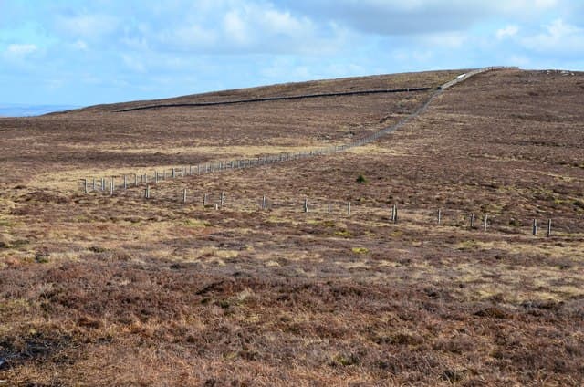
East Cairn Hill sits at the south-western end of the Pentland chain at 567m, in the NT-prefix block above the Cauldstane Slap drove road. A big summit cairn marks the top and the prominence gives wide views over West Lothian and the upper Clyde basin.
Quick facts
- Height
- 567m/ 1860ft
- Prominence
- 172 m
- Grid ref
- NT 12807 59313
- Nearest city
- Edinburgh· 20km
- Dogs
- Dogs on lead required near livestockDog-friendly guide ↗
Height and prominence cross-checked against the Database of British and Irish Hills (CC BY).
No GPX track yet
Walked this route? Share your track to help other walkers.
Standard route
grass moorland 65% · heather 25% · rocky summit 10%
The Cauldstane Slap path from the A70 at Little Vantage climbs a clear track to the bealach before turning west onto the broad summit shoulder. Around 9km return in roughly 3 hours.
Terrain
Old Cauldstane drove-road on the approach, then peaty grass and a few boggy stretches across the bealach before firm ground on the summit shoulder.
In winter
A reliable winter walk by Pentlands standards — the Slap is sheltered, but the open shoulder catches westerly wind. Snow patches linger in the northern gullies into March.
Best time of year
Getting there
- Glasgow2h 13m
- Edinburgh1h 37m
OS maps: OS Landranger 65, OS Landranger 72, OS Explorer 344
Mobile signal: Good. Pentland Hills; EE reliable.
Current conditions
Daylight Today
- Sunrise
- 05:14
- Sunset
- 21:26
- Civil dawn
- 04:25
- Civil dusk
- 22:15
NOAA Solar Calculator · 30 July 2026
Around East Cairn Hill on the SCOT network
Getting there, basing yourself, and what to do off the hill.
East Cairn Hill — common questions
- How hard is East Cairn Hill?
- We grade East Cairn Hill at 2/5, which puts it in moderate territory. Terrain: Old Cauldstane drove-road on the approach, then peaty grass and a few boggy stretches across the bealach before firm ground on the summit shoulder.
- How prominent is East Cairn Hill?
- East Cairn Hill has 172m of topographic prominence — the height of its summit above the highest col connecting it to higher ground. Marilyns are defined by that measure: at least 150m of drop on all sides.
- When should I climb East Cairn Hill?
- The standard good-weather months for East Cairn Hill are March, April, May, June, July, August, September, October. Outside those months, expect winter conditions on the high ground — full mountain kit, navigation skills, and a check of the SAIS avalanche forecast for the relevant region.
- Can I bring my dog up East Cairn Hill?
- On a lead only — the route crosses ground with livestock or nesting-bird interest.
- What's mobile reception like on East Cairn Hill?
- Good. Pentland Hills; EE reliable.
- Is East Cairn Hill safe in winter?
- A reliable winter walk by Pentlands standards — the Slap is sheltered, but the open shoulder catches westerly wind. Snow patches linger in the northern gullies into March.
Get the OutdoorSCOT weekly
One email a week — new route, hill and bothy guides, seasonal conditions and the odd hard-won lesson. No spam, unsubscribe in one click.