Marilyn · Outer Hebrides
Mullach an Eilein
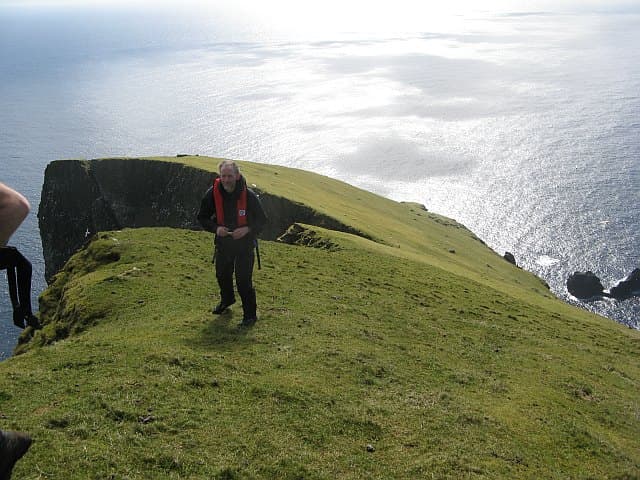
Mullach an Eilein — the 'summit of the island' — is the high point of Boreray in the NA 153 grid square north-east of Hirta. The 384m peak rises from sea cliffs in a single steep grass and rock cone and is among the most committing Marilyns in Britain.
Quick facts
- Height
- 384.3m/ 1261ft
- Prominence
- 384 m
- Grid ref
- NA 15365 05347
- Dogs
- Dogs on lead required near livestockDog-friendly guide ↗
Height and prominence cross-checked against the Database of British and Irish Hills (CC BY).
No GPX track yet
Walked this route? Share your track to help other walkers.
Standard route
maritime grassland 60% · rocky summit 30% · cliff edges 10%
A scrambling ascent from a precarious dinghy landing in calm conditions only. Steep maritime grass and rocky ribs lead to the airy summit. Two to three hours on the island for those few who manage to set foot on it.
Terrain
Vertiginous grass slopes interrupted by gabbro outcrops, with cliffs falling away on every side. The landing point is a wave-washed rock platform that demands a quiet swell.
In winter
No realistic winter access. Even summer charters reach Boreray only when the Atlantic is unusually calm — perhaps a handful of days each year.
Best time of year
Getting there
- Glasgow12h 9m
- Edinburgh15h 36m
Ferry access
Private charter from Leverburgh (Harris) or Oban
- Crossing time180 min
- Summer sailingsNo regular service — chartered day trips and stays May–Sep only, weather dependent
- Winter sailingsNo access in winter
- Book ahead90 days
St Kilda is 64km west of the Outer Hebrides — one of the most remote places in Britain. Access by private charter boat (weather permitting) or NTS-arranged visits. Camping and bothy accommodation available; no day trips possible.
OS maps: OS Landranger 18, OS Explorer 460W
Mobile signal: None. St Kilda; completely off-grid.
Current conditions
Daylight Today
- Sunrise
- 05:23
- Sunset
- 21:58
- Civil dawn
- 04:29
- Civil dusk
- 22:52
NOAA Solar Calculator · 30 July 2026
Mullach an Eilein — common questions
- How hard is Mullach an Eilein?
- We grade Mullach an Eilein at 1/5, which puts it in easy territory. Underfoot: Vertiginous grass slopes interrupted by gabbro outcrops, with cliffs falling away on every side.
- What is Mullach an Eilein's prominence?
- Mullach an Eilein's prominence is its full height — 384m — because it is the highest point of its landmass, with no higher ground connected to it. That drop is what qualifies it as a Marilyn — a hill with at least 150m of descent on every side.
- When is the best time to climb Mullach an Eilein?
- March, April, May, June, July, August, September, October give the most reliable conditions on Mullach an Eilein. Beyond that window the high ground turns wintry: carry full mountain kit, be confident navigating, and check the SAIS avalanche forecast for the area.
- Is Mullach an Eilein dog-friendly?
- Yes, but dogs must be kept on a lead — there is livestock or ground-nesting bird interest on the route.
- Is there mobile signal on Mullach an Eilein?
- None. St Kilda; completely off-grid.
- How do I get the ferry to Mullach an Eilein?
- Private charter from Leverburgh (Harris) or Oban. No regular service — chartered day trips and stays May–Sep only, weather dependent in summer; No access in winter in winter. Book at least 90 days ahead. St Kilda is 64km west of the Outer Hebrides — one of the most remote places in Britain. Access by private charter boat (weather permitting) or NTS-arranged visits. Camping and bothy accommodation available; no day trips possible.
- Is Mullach an Eilein safe in winter?
- No realistic winter access. Even summer charters reach Boreray only when the Atlantic is unusually calm — perhaps a handful of days each year.
Get the OutdoorSCOT weekly
One email a week — new route, hill and bothy guides, seasonal conditions and the odd hard-won lesson. No spam, unsubscribe in one click.