Marilyn · Outer Hebrides
Muirneag
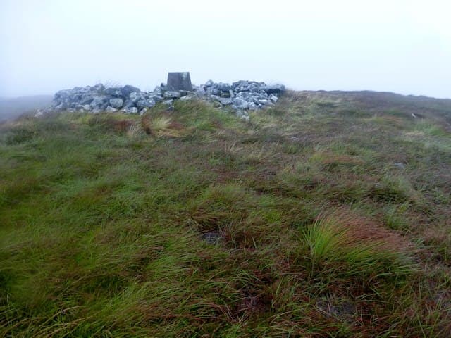
Muirneag is the high point of north Lewis, a lonely 248m peat dome dominating the great flat moor between Stornoway and the Butt of Lewis. The summit is a small rock outcrop set in a sea of bog with views to the Sutherland coast on a clear day.
Quick facts
- Height
- 248m/ 814ft
- Prominence
- 171 m
- Grid ref
- NB 47968 48922
- Dogs
- Dogs on lead required near livestockDog-friendly guide ↗
Height and prominence cross-checked against the Database of British and Irish Hills (CC BY).
No GPX track yet
Walked this route? Share your track to help other walkers.
Standard route
blanket bog 55% · heather moorland 30% · rocky summit 15%
Most walkers start near Tolsta or from the B895 road end and head west across open moorland for several kilometres of boggy walking. A long but flat round of roughly four hours; the difficulty is distance and ground, not height.
Terrain
Featureless blanket bog with deep peat hags, drainage channels and lochans. No paths and few landmarks, so a compass bearing across the moor is normal practice.
In winter
Snow seldom lies but the moor floods and the wind is relentless from the Atlantic. In poor visibility this hill is genuinely hard to navigate on; daylight is short between November and February.
Best time of year
Getting there
- Glasgow8h 22m
- Edinburgh10h 12m
Ferry access
Ullapool → Stornoway (Lewis)
- Crossing time165 min
- Summer sailings2 sailings daily (Apr–Oct)
- Winter sailings1 sailing daily (Nov–Mar)
- Book ahead14 days
- Last ferry backCheck CalMac timetable
Allow 1–2 hours drive from Stornoway to reach the Harris hills. For South Harris hills, Uig → Tarbert may be more convenient.
Book on CalMac ↗OS maps: OS Landranger 8, OS Explorer 460E
Mobile signal: Poor. Remote north Lewis; limited coverage.
Current conditions
Daylight Today
- Sunrise
- 05:12
- Sunset
- 21:52
- Civil dawn
- 04:16
- Civil dusk
- 22:48
NOAA Solar Calculator · 30 July 2026
Around Muirneag on the SCOT network
Getting there, basing yourself, and what to do off the hill.
Muirneag — common questions
- What difficulty is Muirneag?
- On the OutdoorSCOT scale, Muirneag comes in at 2/5 — moderate. Terrain: Featureless blanket bog with deep peat hags, drainage channels and lochans.
- How prominent is Muirneag?
- Muirneag has 171m of topographic prominence — the height of its summit above the highest col connecting it to higher ground. Marilyns are defined by that measure: at least 150m of drop on all sides.
- When should I climb Muirneag?
- The standard good-weather months for Muirneag are April, May, June, July, August, September, October. Outside those months, expect winter conditions on the high ground — full mountain kit, navigation skills, and a check of the SAIS avalanche forecast for the relevant region.
- Can I bring my dog up Muirneag?
- On a lead only — the route crosses ground with livestock or nesting-bird interest.
- What's mobile reception like on Muirneag?
- Poor. Remote north Lewis; limited coverage.
- How do I get the ferry to Muirneag?
- Ullapool → Stornoway (Lewis). 2 sailings daily (Apr–Oct) in summer; 1 sailing daily (Nov–Mar) in winter. Book at least 14 days ahead. Allow 1–2 hours drive from Stornoway to reach the Harris hills. For South Harris hills, Uig → Tarbert may be more convenient.
- Is Muirneag safe in winter?
- Snow seldom lies but the moor floods and the wind is relentless from the Atlantic. In poor visibility this hill is genuinely hard to navigate on; daylight is short between November and February.
Get the OutdoorSCOT weekly
One email a week — new route, hill and bothy guides, seasonal conditions and the odd hard-won lesson. No spam, unsubscribe in one click.