Marilyn · Galloway
Middlefield Law
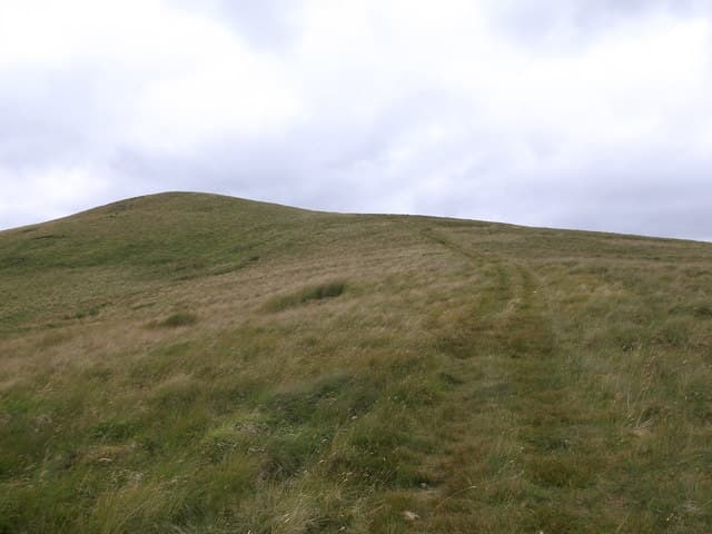
Middlefield Law sits at NS68 above the upper Irvine valley in East Ayrshire, a 466m grass-and-heather rise on the windswept moors between Darvel and Sorn. Whitelee Wind Farm dominates the northern view from the summit.
Quick facts
- Height
- 466m/ 1529ft
- Prominence
- 168 m
- Grid ref
- NS 68106 30726
- Parking
- NS 684 311
- Nearest city
- Glasgow· 36km
- Dogs
- Dogs on lead required near livestockDog-friendly guide ↗
Height and prominence cross-checked against the Database of British and Irish Hills (CC BY).
No GPX track yet
Walked this route? Share your track to help other walkers.
Standard route
heather moorland 60% · grass slopes 30% · boggy ground 10%
From a forestry pull-in on the back road from Darvel to Sorn, walk up the access track through the trees onto open moorland. Bear south on faint quad tracks to gain the summit and its small cairn.
Terrain
Forestry road for the lower section then trackless heather and rough grass. Stretches of peat hag below the summit dome — wet underfoot after rain.
In winter
A featureless winter objective with no shelter on the summit plateau. Whitelee turbines provide bearings to the north; otherwise this is map and compass terrain in cloud.
Best time of year
Getting there
- Glasgow1h 53m
- Edinburgh3h 33m
OS maps: OS Landranger 71, OS Explorer 334
Mobile signal: Good. East Ayrshire; EE reasonable.
Current conditions
Daylight Today
- Sunrise
- 05:18
- Sunset
- 21:27
- Civil dawn
- 04:30
- Civil dusk
- 22:16
NOAA Solar Calculator · 30 July 2026
Around Middlefield Law on the SCOT network
Getting there, basing yourself, and what to do off the hill.
Middlefield Law — common questions
- What difficulty is Middlefield Law?
- On the OutdoorSCOT scale, Middlefield Law comes in at 1/5 — easy. Ground conditions: Forestry road for the lower section then trackless heather and rough grass.
- How much drop does Middlefield Law have?
- The drop is 168m: measured from the summit of Middlefield Law down to the saddle joining it to higher terrain. Passing the 150m-drop threshold on all sides is exactly what makes it a Marilyn.
- Where's the parking for Middlefield Law?
- Park at NS 684 311. Double-check the grid reference on an OS map first; informal laybys here fill early in high season.
- What's the best month to climb Middlefield Law?
- Aim for March, April, May, June, July, August, September, October on Middlefield Law. In the remaining months treat it as a winter hill — full kit, solid navigation, and a look at the relevant SAIS avalanche forecast before you go.
- Can dogs go up Middlefield Law?
- Dogs are fine on a lead. The route passes livestock or ground-nesting bird habitat, so keep them close throughout.
- Will I get phone signal on Middlefield Law?
- Good. East Ayrshire; EE reasonable.
- Is Middlefield Law safe in winter?
- A featureless winter objective with no shelter on the summit plateau. Whitelee turbines provide bearings to the north; otherwise this is map and compass terrain in cloud.
Get the OutdoorSCOT weekly
One email a week — new route, hill and bothy guides, seasonal conditions and the odd hard-won lesson. No spam, unsubscribe in one click.