Marilyn · Galloway
Cairn Table
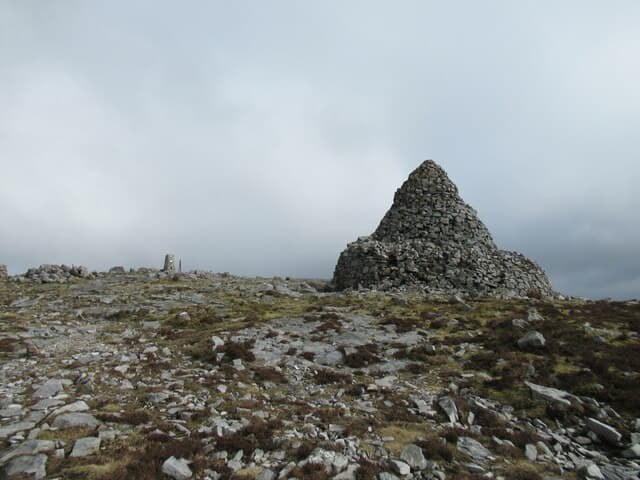
A 593m flat-topped Marilyn at NS 72 east of Muirkirk, the high point of the Muirkirk Uplands. Cairn Table carries two large summit cairns — one a memorial to the Muirkirk dead of the Great War — and a wide tableland of heather.
Quick facts
- Height
- 593m/ 1946ft
- Prominence
- 323 m
- Grid ref
- NS 72431 24224
- Nearest city
- Glasgow· 43km
- Dogs
- Dogs on lead required near livestockDog-friendly guide ↗
Height and prominence cross-checked against the Database of British and Irish Hills (CC BY).
No GPX track yet
Walked this route? Share your track to help other walkers.
Standard route
heather moorland 55% · grass slopes 30% · rocky/flat summit 15%
Start from Muirkirk and follow the well-marked path south-east past Tibbie's Brig and up onto the open hill. The path leads directly to the war memorial cairn on the summit plateau — 3 to 4 hours round trip.
Terrain
Good waymarked path on firm peat and gravel; the table summit is grass and short heather underfoot.
In winter
Snow can lie on the flat top through cold spells but rarely deep. The marked path stays followable in most conditions — useful when other Southern Uplands hills are out.
Best time of year
Getting there
- Glasgow1h 6m
- Edinburgh2h 27m
OS maps: OS Landranger 71, OS Explorer 328N
Mobile signal: Good. East Ayrshire/South Lanarkshire; EE reliable.
Current conditions
Daylight Today
- Sunrise
- 05:19
- Sunset
- 21:27
- Civil dawn
- 04:30
- Civil dusk
- 22:15
NOAA Solar Calculator · 30 July 2026
Around Cairn Table on the SCOT network
Getting there, basing yourself, and what to do off the hill.
Cairn Table — common questions
- How difficult is Cairn Table?
- Cairn Table carries a 2/5 (moderate) grade on the OutdoorSCOT scale. Terrain: Good waymarked path on firm peat and gravel; the table summit is grass and short heather underfoot.
- How prominent is Cairn Table?
- Cairn Table has 323m of topographic prominence — the height of its summit above the highest col connecting it to higher ground. Marilyns are defined by that measure: at least 150m of drop on all sides.
- When should I climb Cairn Table?
- The standard good-weather months for Cairn Table are March, April, May, June, July, August, September, October. Outside those months, expect winter conditions on the high ground — full mountain kit, navigation skills, and a check of the SAIS avalanche forecast for the relevant region.
- Can I bring my dog up Cairn Table?
- On a lead only — the route crosses ground with livestock or nesting-bird interest.
- What's mobile reception like on Cairn Table?
- Good. East Ayrshire/South Lanarkshire; EE reliable.
- Is Cairn Table safe in winter?
- Snow can lie on the flat top through cold spells but rarely deep. The marked path stays followable in most conditions — useful when other Southern Uplands hills are out.
Get the OutdoorSCOT weekly
One email a week — new route, hill and bothy guides, seasonal conditions and the odd hard-won lesson. No spam, unsubscribe in one click.