Marilyn · Galloway
Kirkland Hill
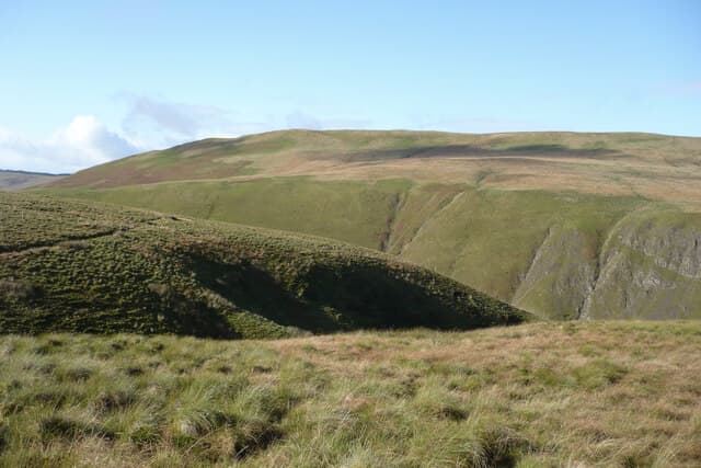
Kirkland Hill stands at 511m on the NS-grid uplands north of New Cumnock, an East Ayrshire moorland summit above the Lugar Water. Its setting near the Glen Afton wind cluster gives the climb easy access via service roads.
Quick facts
- Height
- 511m/ 1677ft
- Prominence
- 163 m
- Grid ref
- NS 73162 16286
- Nearest city
- Dumfries· 47km
- Dogs
- Dogs on lead required near livestockDog-friendly guide ↗
Height and prominence cross-checked against the Database of British and Irish Hills (CC BY).
No GPX track yet
Walked this route? Share your track to help other walkers.
Standard route
heather moorland 55% · grass slopes 35% · rocky summit 10%
From the minor road near Polquhirter, follow the wind-farm tracks up to ridge height before striking out across heather to the cairn. Two and a half to three hours suffices; the access tracks shorten what would otherwise be a tussocky slog.
Terrain
Wind-farm haul roads on the lower slopes give way to deep heather and broken peat groughs on the summit plateau. The cairn area is firm grass.
In winter
Lying snow is occasional but the site catches strong gusts off the Firth of Clyde. Frozen service-road ruts are the most likely trip hazard.
Best time of year
Getting there
- Glasgow1h 17m
- Edinburgh3h 30m
OS maps: OS Landranger 71, OS Explorer 328N
Mobile signal: Good. East Ayrshire; EE reliable. Good coverage from nearby mast.
Current conditions
Daylight Today
- Sunrise
- 06:46
- Sunset
- 19:38
- Civil dawn
- 06:08
- Civil dusk
- 20:15
NOAA Solar Calculator · 14 September 2026
Around Kirkland Hill on the SCOT network
Getting there, basing yourself, and what to do off the hill.
Kirkland Hill — common questions
- How difficult is Kirkland Hill?
- Kirkland Hill carries a 2/5 (moderate) grade on the OutdoorSCOT scale. Ground conditions: Wind-farm haul roads on the lower slopes give way to deep heather and broken peat groughs on the summit plateau.
- How much drop does Kirkland Hill have?
- The drop is 163m: measured from the summit of Kirkland Hill down to the saddle joining it to higher terrain. Passing the 150m-drop threshold on all sides is exactly what makes it a Marilyn.
- What's the best month to climb Kirkland Hill?
- Aim for March, April, May, June, July, August, September, October on Kirkland Hill. In the remaining months treat it as a winter hill — full kit, solid navigation, and a look at the relevant SAIS avalanche forecast before you go.
- Can dogs go up Kirkland Hill?
- Dogs are fine on a lead. The route passes livestock or ground-nesting bird habitat, so keep them close throughout.
- Will I get phone signal on Kirkland Hill?
- Good. East Ayrshire; EE reliable. Good coverage from nearby mast.
- Is Kirkland Hill safe in winter?
- Lying snow is occasional but the site catches strong gusts off the Firth of Clyde. Frozen service-road ruts are the most likely trip hazard.
Get the OutdoorSCOT weekly
One email a week — new route, hill and bothy guides, seasonal conditions and the odd hard-won lesson. No spam, unsubscribe in one click.