Marilyn · Torridon
Meall Lochan a' Chleirich
Meall Lochan a' Chleirich — the lump of the cleric's lochan — rises to 403m at NG 872 716 in the rough country between Loch Maree and Gairloch. A small lochan immediately west of the summit, perhaps once associated with a wandering monk or chapel site, supplies the name.
Gaelic: “rounded hill, small loch, of the” · Pronunciation: myowl loch-an uh chleirich
Quick facts
- Height
- 403m/ 1322ft
- Prominence
- 216 m
- Grid ref
- NG 87218 71611
- Nearest city
- Inverness· 83km
- Dogs
- Dogs on lead required near livestockDog-friendly guide ↗
Height and prominence cross-checked against the Database of British and Irish Hills (CC BY).
No GPX track yet
Walked this route? Share your track to help other walkers.
Standard route
heather moorland 60% · lochside bog 25% · rocky summit 15%
Approach from the layby on the A832 above the south shore of Loch Maree. Cross the bridge then climb pathless ground north-west, with the lochan a useful landmark just below the summit. About 3-4 hours.
Terrain
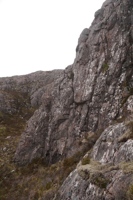
Knock-and-lochan terrain at its most pronounced. Small rocky knolls alternate with peat bogs and pools, demanding careful route choice; there is no path. Boggy edges around the eponymous lochan need particular care.
In winter
A coastal Wester Ross summit where Atlantic weather dominates. Lying snow is uncommon; lethal hidden ice on slabs after cold spells is the real danger. Short, dark days limit summer-style outings to late morning starts.
This hill is in the Torridon SAIS forecast area. Check SAIS forecasts in winter (December–April).
Best time of year
Getting there
- Glasgow6h 49m
- Edinburgh8h 37m
OS maps: OS Landranger 19, OS Explorer 433, OS Explorer 434
Mobile signal: Poor. Signal drops completely on the approach; all networks fail here.
Current conditions
Daylight Today
- Sunrise
- 05:13
- Sunset
- 21:45
- Civil dawn
- 04:19
- Civil dusk
- 22:39
NOAA Solar Calculator · 30 July 2026
Around Meall Lochan a' Chleirich on the SCOT network
Getting there, basing yourself, and what to do off the hill.
Meall Lochan a' Chleirich — common questions
- Is Meall Lochan a' Chleirich a hard climb?
- Meall Lochan a' Chleirich is rated 1/5 (easy) on the OutdoorSCOT scale. Terrain: Knock-and-lochan terrain at its most pronounced.
- How prominent is Meall Lochan a' Chleirich?
- Meall Lochan a' Chleirich has 216m of topographic prominence — the height of its summit above the highest col connecting it to higher ground. Marilyns are defined by that measure: at least 150m of drop on all sides.
- When should I climb Meall Lochan a' Chleirich?
- The standard good-weather months for Meall Lochan a' Chleirich are March, April, May, June, July, August, September, October. Outside those months, expect winter conditions on the high ground — full mountain kit, navigation skills, and a check of the SAIS avalanche forecast for the relevant region.
- Can I bring my dog up Meall Lochan a' Chleirich?
- On a lead only — the route crosses ground with livestock or nesting-bird interest.
- What's mobile reception like on Meall Lochan a' Chleirich?
- Poor. Signal drops completely on the approach; all networks fail here.
- Is Meall Lochan a' Chleirich safe in winter?
- A coastal Wester Ross summit where Atlantic weather dominates. Lying snow is uncommon; lethal hidden ice on slabs after cold spells is the real danger. Short, dark days limit summer-style outings to late morning starts.
Get the OutdoorSCOT weekly
One email a week — new route, hill and bothy guides, seasonal conditions and the odd hard-won lesson. No spam, unsubscribe in one click.