Marilyn · North-West Highlands
Meall Dheirgidh
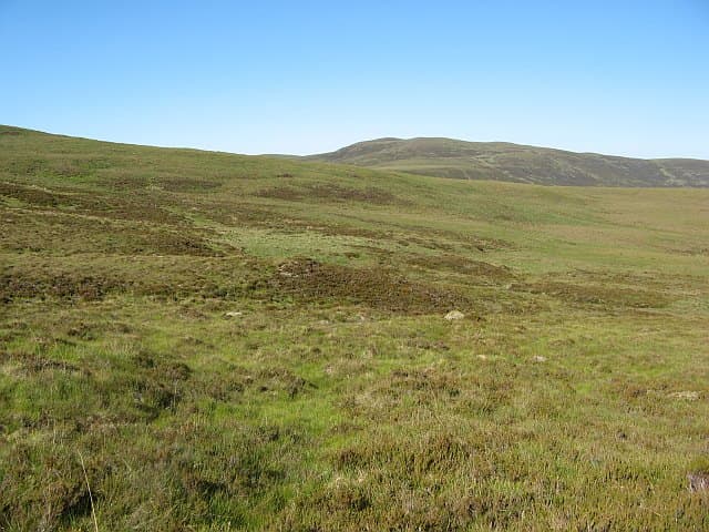
Meall Dheirgidh — the reddish rounded hill — is a 506m rise at NH 473 943 on the watershed between Strath Carron and the Kyle of Sutherland. The name describes a band of reddened sandstone that traces across its flank, conspicuous after rain when the colour deepens to rust.
Quick facts
- Height
- 506m/ 1660ft
- Prominence
- 303 m
- Grid ref
- NH 47314 94339
- Nearest city
- Inverness· 53km
- Dogs
- Dogs on lead required near livestockDog-friendly guide ↗
Height and prominence cross-checked against the Database of British and Irish Hills (CC BY).
No GPX track yet
Walked this route? Share your track to help other walkers.
Standard route
heather and bog 65% · grass slopes 25% · rocky summit 10%
Best taken from the Croick road end west of Ardgay, walking 3km up the historic drove route before turning south onto the hill. The red sandstone band gives a clear navigation marker on the climb. A 4-hour outing.
Terrain
Old Red Sandstone outcrops in horizontal terraces, giving a stepped profile to the ascent. Between the steps the ground is heather and peat; the summit itself is a small grassy top with a low cairn.
In winter
The east aspect dries early after thaw and is one of the first hills in the area to come into condition for spring walking. Snow rarely lies long below 500m, but verglas on the sandstone steps is common after a thaw-and-freeze cycle.
This hill is in the Torridon SAIS forecast area. Check SAIS forecasts in winter (December–April).
Best time of year
Getting there
- Glasgow5h 22m
- Edinburgh6h 13m
OS maps: OS Landranger 20, OS Explorer 440S
Mobile signal: Poor. No coverage on approach or summit. Emergency whistle and PLB recommended.
Current conditions
Daylight Today
- Sunrise
- 05:07
- Sunset
- 21:42
- Civil dawn
- 04:13
- Civil dusk
- 22:37
NOAA Solar Calculator · 30 July 2026
Around Meall Dheirgidh on the SCOT network
Getting there, basing yourself, and what to do off the hill.
Getting there: Ardgay station
Kyle of Sutherland; Croick; Far North Line
13km from the hill
tripscot.co.uk
On TripSCOTBase yourself in Ullapool
Main NW Highlands hub; Hebrides ferry; Inverpolly access
34km from the hill
tripscot.co.uk
On TasteSCOTAfter the hill: Balblair
Edderton — Easter Ross distillery with vintage-led range
25km from the hill
tastescot.co.uk
Meall Dheirgidh — common questions
- How difficult is Meall Dheirgidh?
- Meall Dheirgidh carries a 2/5 (moderate) grade on the OutdoorSCOT scale. Underfoot: Old Red Sandstone outcrops in horizontal terraces, giving a stepped profile to the ascent.
- What is Meall Dheirgidh's prominence?
- 303m of prominence. That's the vertical drop from the summit to the col that links Meall Dheirgidh to the next higher ground. That drop is what qualifies it as a Marilyn — a hill with at least 150m of descent on every side.
- When is the best time to climb Meall Dheirgidh?
- March, April, May, June, July, August, September, October give the most reliable conditions on Meall Dheirgidh. Beyond that window the high ground turns wintry: carry full mountain kit, be confident navigating, and check the SAIS avalanche forecast for the area.
- Is Meall Dheirgidh dog-friendly?
- Yes, but dogs must be kept on a lead — there is livestock or ground-nesting bird interest on the route.
- Is there mobile signal on Meall Dheirgidh?
- Poor. No coverage on approach or summit. Emergency whistle and PLB recommended.
- Is Meall Dheirgidh safe in winter?
- The east aspect dries early after thaw and is one of the first hills in the area to come into condition for spring walking. Snow rarely lies long below 500m, but verglas on the sandstone steps is common after a thaw-and-freeze cycle.
Get the OutdoorSCOT weekly
One email a week — new route, hill and bothy guides, seasonal conditions and the odd hard-won lesson. No spam, unsubscribe in one click.