Marilyn · Galloway
Killyleoch Hill
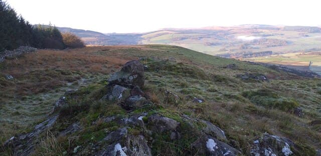
A 239m Marilyn rising from the Urr Water lowlands east of Castle Douglas, in the NX prefix country of Dumfriesshire. Modest in height, but the prominence above the surrounding rough pasture lets the summit feel like a real high point.
Quick facts
- Height
- 239.7m/ 786ft
- Prominence
- 152 m
- Grid ref
- NX 87859 82034
- Nearest city
- Dumfries· 11km
- Dogs
- Dogs on lead required near livestockDog-friendly guide ↗
Height and prominence cross-checked against the Database of British and Irish Hills (CC BY).
No GPX track yet
Walked this route? Share your track to help other walkers.
Standard route
heather moorland 60% · rough grassland 30% · rocky summit 10%
A short walk from minor roads near the Urr Water onto rough Galloway pasture and bracken-banked slopes leading up to the 239m summit. Best tackled in under two hours when the bracken is down.
Terrain
Rough Dumfriesshire pasture, gorse and bracken on the lower flanks, with stiles and fence-lines to negotiate before reaching open ground near the summit.
In winter
A low-altitude winter option close to the Solway coast. Snow rarely lingers, but the bracken slopes can be slick after frost and the lower fields turn muddy.
Best time of year
Getting there
- Glasgow2h 17m
- Edinburgh3h 36m
OS maps: OS Landranger 78, OS Explorer 321
Mobile signal: Good. Dumfriesshire; EE reliable on summit and approach.
Current conditions
Daylight Today
- Sunrise
- 05:19
- Sunset
- 21:24
- Civil dawn
- 04:32
- Civil dusk
- 22:11
NOAA Solar Calculator · 30 July 2026
Around Killyleoch Hill on the SCOT network
Getting there, basing yourself, and what to do off the hill.
Killyleoch Hill — common questions
- What difficulty is Killyleoch Hill?
- On the OutdoorSCOT scale, Killyleoch Hill comes in at 1/5 — easy. Ground conditions: Rough Dumfriesshire pasture, gorse and bracken on the lower flanks, with stiles and fence-lines to negotiate before reaching open ground near the summit.
- How much drop does Killyleoch Hill have?
- The drop is 152m: measured from the summit of Killyleoch Hill down to the saddle joining it to higher terrain. Passing the 150m-drop threshold on all sides is exactly what makes it a Marilyn.
- What's the best month to climb Killyleoch Hill?
- Aim for March, April, May, June, July, August, September, October on Killyleoch Hill. In the remaining months treat it as a winter hill — full kit, solid navigation, and a look at the relevant SAIS avalanche forecast before you go.
- Can dogs go up Killyleoch Hill?
- Dogs are fine on a lead. The route passes livestock or ground-nesting bird habitat, so keep them close throughout.
- Will I get phone signal on Killyleoch Hill?
- Good. Dumfriesshire; EE reliable on summit and approach.
- Is Killyleoch Hill safe in winter?
- A low-altitude winter option close to the Solway coast. Snow rarely lingers, but the bracken slopes can be slick after frost and the lower fields turn muddy.
Get the OutdoorSCOT weekly
One email a week — new route, hill and bothy guides, seasonal conditions and the odd hard-won lesson. No spam, unsubscribe in one click.