Marilyn · Kintail
Creag Dhubh
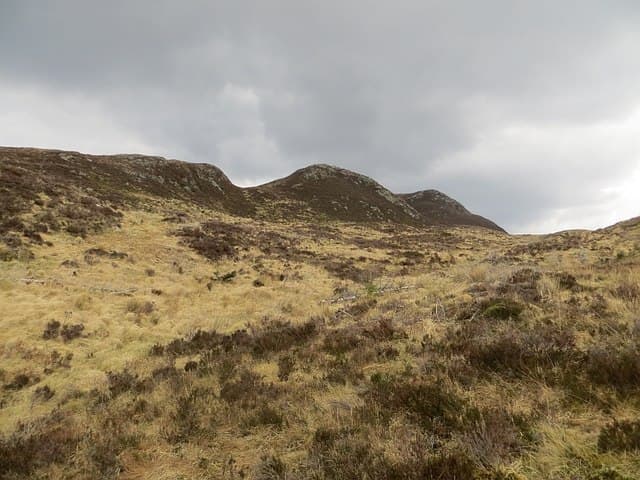
Creag Dhubh, the black crag, stands at 539m at NH 225 216 on the watershed between Glen Cannich and Glen Affric. Dark schist outcrops on its eastern face give the hill its name; the western slopes are gentler and grassier.
Gaelic: “crag, black” · Pronunciation: krayg goo
Quick facts
- Height
- 539m/ 1768ft
- Prominence
- 204 m
- Grid ref
- NH 22506 21645
- Nearest city
- Fort William· 49km
- Dogs
- Dogs on lead required near livestockDog-friendly guide ↗
Height and prominence cross-checked against the Database of British and Irish Hills (CC BY).
No GPX track yet
Walked this route? Share your track to help other walkers.
Standard route
heather moorland 50% · rocky slopes 35% · grass slopes 15%
Most parties start from the Affric road near Tomich, taking the forest track north before breaking out onto the heathery shoulder. Roughly 4-5 hours including the diversion along the broad summit ridge.
Terrain
Plantation tracks lead almost to the open hillside, after which it is wet heather and tussock for the bulk of the climb. The eastern crags are best avoided in mist; keep to the broad western shoulder.
In winter
Sheltered by the Affric massif, the hill sees patchy snow rather than deep accumulation. The dark eastern crags ice up freely and can be hard to descry in poor light. A walking axe is sensible from late December.
Best time of year
Getting there
- Glasgow4h 1m
- Edinburgh6h 39m
OS maps: OS Landranger 25, OS Explorer 415
Mobile signal: Poor. Remote Highland area; limited coverage.
Current conditions
Daylight Today
- Sunrise
- 05:13
- Sunset
- 21:40
- Civil dawn
- 04:20
- Civil dusk
- 22:32
NOAA Solar Calculator · 30 July 2026
Around Creag Dhubh on the SCOT network
Getting there, basing yourself, and what to do off the hill.
Creag Dhubh — common questions
- What difficulty is Creag Dhubh?
- On the OutdoorSCOT scale, Creag Dhubh comes in at 2/5 — moderate. Underfoot: Plantation tracks lead almost to the open hillside, after which it is wet heather and tussock for the bulk of the climb.
- What is Creag Dhubh's prominence?
- 204m of prominence. That's the vertical drop from the summit to the col that links Creag Dhubh to the next higher ground. That drop is what qualifies it as a Marilyn — a hill with at least 150m of descent on every side.
- When is the best time to climb Creag Dhubh?
- March, April, May, June, July, August, September, October give the most reliable conditions on Creag Dhubh. Beyond that window the high ground turns wintry: carry full mountain kit, be confident navigating, and check the SAIS avalanche forecast for the area.
- Is Creag Dhubh dog-friendly?
- Yes, but dogs must be kept on a lead — there is livestock or ground-nesting bird interest on the route.
- Is there mobile signal on Creag Dhubh?
- Poor. Remote Highland area; limited coverage.
- Is Creag Dhubh safe in winter?
- Sheltered by the Affric massif, the hill sees patchy snow rather than deep accumulation. The dark eastern crags ice up freely and can be hard to descry in poor light. A walking axe is sensible from late December.
Get the OutdoorSCOT weekly
One email a week — new route, hill and bothy guides, seasonal conditions and the odd hard-won lesson. No spam, unsubscribe in one click.