Marilyn · Kintail
Carn nam Bad
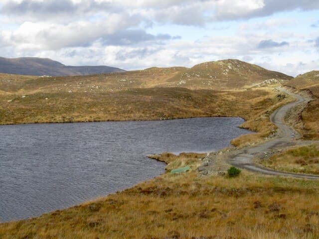
Carn nam Bad — cairn of the clumps or tufts — rises to 458m at NH 401 339 in the rolling country between Strathconon and Glen Orrin. The Gaelic bad denotes tussocky thickets, and that is exactly what dresses the lower hillside.
Quick facts
- Height
- 458.1m/ 1503ft
- Prominence
- 212 m
- Grid ref
- NH 40174 33913
- Nearest city
- Inverness· 29km
- Dogs
- Dogs on lead required near livestockDog-friendly guide ↗
Height and prominence cross-checked against the Database of British and Irish Hills (CC BY).
No GPX track yet
Walked this route? Share your track to help other walkers.
Standard route
heather moorland 65% · grass slopes 25% · rocky summit 10%
Approach from the dam at Loch Beannacharain in Strathconon. An estate track gives some height before pathless heather leads onto the broad rounded summit. About 4 hours for the out and back.
Terrain
The track gives a kilometre or so of easy walking; then it is dense tussock with hidden ditches. The summit dome itself is firm short heather and grass — the slog is in the middle ground.
In winter
Mid-altitude Strathconon hill where snow blows around rather than piling up. The frozen ground above 300m actually makes for the easiest walking of the year. Compass essential in cloud on the broad plateau.
Best time of year
Getting there
- Glasgow4h 2m
- Edinburgh5h 17m
OS maps: OS Landranger 26, OS Explorer 431
Mobile signal: Weak. EE absent; closest coverage near Dingwall or Inverness.
Current conditions
Daylight Today
- Sunrise
- 05:11
- Sunset
- 21:39
- Civil dawn
- 04:18
- Civil dusk
- 22:32
NOAA Solar Calculator · 30 July 2026
Around Carn nam Bad on the SCOT network
Getting there, basing yourself, and what to do off the hill.
Getting there: Inverness station
Highland capital — Cairngorms east side, Affric, Far North via bus/car
29km from the hill
tripscot.co.uk
On TripSCOTBase yourself in Inverness
Highland capital — gateway to Cairngorms, Affric, Far North
29km from the hill
tripscot.co.uk
On TasteSCOTAfter the hill: Glen Ord
Muir of Ord — Black Isle distillery; the Singleton range's Highland anchor
21km from the hill
tastescot.co.uk
Carn nam Bad — common questions
- Is Carn nam Bad a hard climb?
- Carn nam Bad is rated 1/5 (easy) on the OutdoorSCOT scale. Ground conditions: The track gives a kilometre or so of easy walking; then it is dense tussock with hidden ditches.
- How much drop does Carn nam Bad have?
- The drop is 212m: measured from the summit of Carn nam Bad down to the saddle joining it to higher terrain. Passing the 150m-drop threshold on all sides is exactly what makes it a Marilyn.
- What's the best month to climb Carn nam Bad?
- Aim for March, April, May, June, July, August, September, October on Carn nam Bad. In the remaining months treat it as a winter hill — full kit, solid navigation, and a look at the relevant SAIS avalanche forecast before you go.
- Can dogs go up Carn nam Bad?
- Dogs are fine on a lead. The route passes livestock or ground-nesting bird habitat, so keep them close throughout.
- Will I get phone signal on Carn nam Bad?
- Weak. EE absent; closest coverage near Dingwall or Inverness.
- Is Carn nam Bad safe in winter?
- Mid-altitude Strathconon hill where snow blows around rather than piling up. The frozen ground above 300m actually makes for the easiest walking of the year. Compass essential in cloud on the broad plateau.
Get the OutdoorSCOT weekly
One email a week — new route, hill and bothy guides, seasonal conditions and the odd hard-won lesson. No spam, unsubscribe in one click.