Marilyn · Orkney & Shetland
Blotchnie Fiold
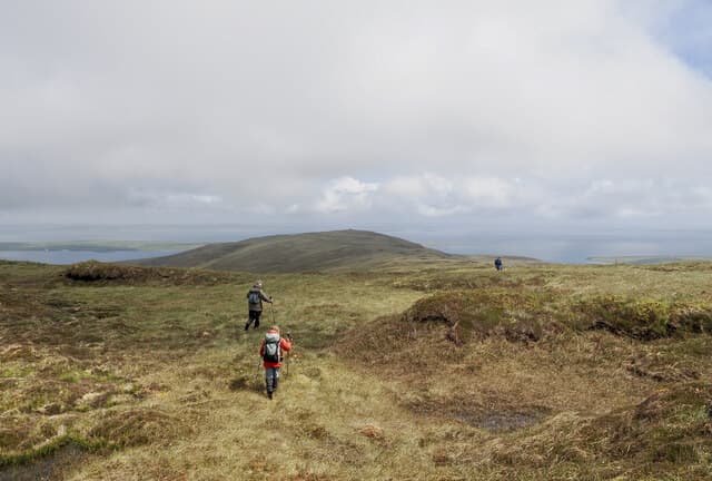
Blotchnie Fiold is the highest point of Rousay, the small green island sometimes called "the Egypt of the north" for its concentration of prehistoric tombs. The 250m summit rises in the centre of the island and gives wide views over the Eynhallow Sound to the Mainland.
Quick facts
- Height
- 250m/ 820ft
- Prominence
- 250 m
- Grid ref
- HY 41814 28917
- Dogs
- Dogs on lead required near livestockDog-friendly guide ↗
Height and prominence cross-checked against the Database of British and Irish Hills (CC BY).
No GPX track yet
Walked this route? Share your track to help other walkers.
Standard route
blanket bog 55% · heather moorland 30% · rocky summit 15%
Start from the road that loops Rousay and head onto the open hill above Wasbister, then follow the broad ridge to the summit. Pathless but easy to navigate by the high ground in clear weather.
Terrain
Heather and short grass over flagstone, with peat patches in the hollows of the moor. Drier and firmer than the Shetland equivalents.
In winter
Rousay ferries from Tingwall on Mainland run year round but cancel in any northerly swell. Snow is rare; wind and short daylight are the principal winter issues.
Best time of year
Getting there
- Glasgow9h 4m
- Edinburgh8h 16m
Ferry access
Scrabster → Stromness (Orkney)
- Crossing time90 min
- Summer sailings3 sailings daily (Apr–Oct)
- Winter sailings2 sailings daily (Nov–Mar)
- Book ahead7 days
- Last ferry backCheck NorthLink timetable — last sailing back varies seasonally
Alternative: Pentland Ferries from Gills Bay → St Margaret's Hope (1h, more frequent) or Aberdeen → Kirkwall overnight. Hoy hills are a further short inter-island ferry hop from Stromness.
Book on ferry operator ↗OS maps: OS Landranger 5, OS Landranger 6, OS Explorer 463, OS Explorer 464
Mobile signal: Poor. Rousay has thin coverage away from the loop road.
Current conditions
Daylight Today
- Sunrise
- 04:53
- Sunset
- 21:44
- Civil dawn
- 03:55
- Civil dusk
- 22:42
NOAA Solar Calculator · 30 July 2026
Around Blotchnie Fiold on the SCOT network
Getting there, basing yourself, and what to do off the hill.
Blotchnie Fiold — common questions
- How hard is Blotchnie Fiold?
- We grade Blotchnie Fiold at 1/5, which puts it in easy territory. Terrain: Heather and short grass over flagstone, with peat patches in the hollows of the moor.
- How prominent is Blotchnie Fiold?
- Blotchnie Fiold's prominence is its full height — 250m — because it is the highest point of its landmass, with no higher ground connected to it. Marilyns are defined by that measure: at least 150m of drop on all sides.
- When should I climb Blotchnie Fiold?
- The standard good-weather months for Blotchnie Fiold are March, April, May, June, July, August, September, October. Outside those months, expect winter conditions on the high ground — full mountain kit, navigation skills, and a check of the SAIS avalanche forecast for the relevant region.
- Can I bring my dog up Blotchnie Fiold?
- On a lead only — the route crosses ground with livestock or nesting-bird interest.
- What's mobile reception like on Blotchnie Fiold?
- Poor. Rousay has thin coverage away from the loop road.
- How do I get the ferry to Blotchnie Fiold?
- Scrabster → Stromness (Orkney). 3 sailings daily (Apr–Oct) in summer; 2 sailings daily (Nov–Mar) in winter. Book at least 7 days ahead. Alternative: Pentland Ferries from Gills Bay → St Margaret's Hope (1h, more frequent) or Aberdeen → Kirkwall overnight. Hoy hills are a further short inter-island ferry hop from Stromness.
- Is Blotchnie Fiold safe in winter?
- Rousay ferries from Tingwall on Mainland run year round but cancel in any northerly swell. Snow is rare; wind and short daylight are the principal winter issues.
Get the OutdoorSCOT weekly
One email a week — new route, hill and bothy guides, seasonal conditions and the odd hard-won lesson. No spam, unsubscribe in one click.