Marilyn · Orkney & Shetland
Milldoe - Mid Tooin
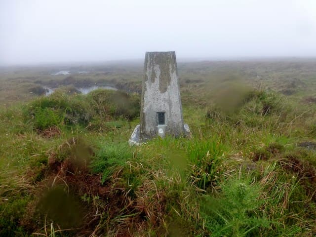
Milldoe — sometimes called Mid Tooin — is the high point of the West Mainland ridge that runs from Wideford north to Costa Head. At 224m it is the third on that line of summits and gives an open view across the lochs and the Atlantic coast.
Quick facts
- Height
- 224m/ 735ft
- Prominence
- 188 m
- Grid ref
- HY 35827 20695
- Dogs
- Dogs on lead required near livestockDog-friendly guide ↗
Height and prominence cross-checked against the Database of British and Irish Hills (CC BY).
No GPX track yet
Walked this route? Share your track to help other walkers.
Standard route
blanket bog 55% · heather moorland 30% · rocky summit 15%
Access from the road near Dounby or from the track that climbs out of the Loch of Swannay basin, then a short walk across open moor to the cairn. Easily linked with Mid Hill for a fuller day on the ridge.
Terrain
Orkney moorland heather over flagstone, with small peat sections and a flat grassy summit. Underfoot is generally firm and the long views make navigation simple in clear weather.
In winter
Wind and short daylight are the main constraints; snow rarely lies long. The ridge gives little shelter so a strong westerly is harder than a heavy frost here.
Best time of year
Getting there
- Glasgow9h 48m
- Edinburgh8h 4m
Ferry access
Scrabster → Stromness (Orkney)
- Crossing time90 min
- Summer sailings3 sailings daily (Apr–Oct)
- Winter sailings2 sailings daily (Nov–Mar)
- Book ahead7 days
- Last ferry backCheck NorthLink timetable — last sailing back varies seasonally
Alternative: Pentland Ferries from Gills Bay → St Margaret's Hope (1h, more frequent) or Aberdeen → Kirkwall overnight. Hoy hills are a further short inter-island ferry hop from Stromness.
Book on ferry operator ↗OS maps: OS Landranger 6, OS Explorer 463
Mobile signal: Moderate. EE on West Mainland Orkney is reasonable, with patches of poor signal in hollows.
Current conditions
Daylight Today
- Sunrise
- 04:54
- Sunset
- 21:44
- Civil dawn
- 03:56
- Civil dusk
- 22:42
NOAA Solar Calculator · 30 July 2026
Around Milldoe - Mid Tooin on the SCOT network
Getting there, basing yourself, and what to do off the hill.
Getting there: Thurso station
End of the Far North Line — Dunnet Head, Pentland Firth, Orkney ferry
57km from the hill
tripscot.co.uk
On TasteSCOTAfter the hill: Highland Park
Kirkwall, Orkney — heather-infused peat; northernmost Scotch distillery proper
15km from the hill
tastescot.co.uk
Milldoe - Mid Tooin — common questions
- How hard is Milldoe - Mid Tooin?
- We grade Milldoe - Mid Tooin at 1/5, which puts it in easy territory. Underfoot: Orkney moorland heather over flagstone, with small peat sections and a flat grassy summit.
- What is Milldoe - Mid Tooin's prominence?
- 188m of prominence. That's the vertical drop from the summit to the col that links Milldoe - Mid Tooin to the next higher ground. That drop is what qualifies it as a Marilyn — a hill with at least 150m of descent on every side.
- When is the best time to climb Milldoe - Mid Tooin?
- March, April, May, June, July, August, September, October give the most reliable conditions on Milldoe - Mid Tooin. Beyond that window the high ground turns wintry: carry full mountain kit, be confident navigating, and check the SAIS avalanche forecast for the area.
- Is Milldoe - Mid Tooin dog-friendly?
- Yes, but dogs must be kept on a lead — there is livestock or ground-nesting bird interest on the route.
- Is there mobile signal on Milldoe - Mid Tooin?
- Moderate. EE on West Mainland Orkney is reasonable, with patches of poor signal in hollows.
- How do I get the ferry to Milldoe - Mid Tooin?
- Scrabster → Stromness (Orkney). 3 sailings daily (Apr–Oct) in summer; 2 sailings daily (Nov–Mar) in winter. Book at least 7 days ahead. Alternative: Pentland Ferries from Gills Bay → St Margaret's Hope (1h, more frequent) or Aberdeen → Kirkwall overnight. Hoy hills are a further short inter-island ferry hop from Stromness.
- Is Milldoe - Mid Tooin safe in winter?
- Wind and short daylight are the main constraints; snow rarely lies long. The ridge gives little shelter so a strong westerly is harder than a heavy frost here.
Get the OutdoorSCOT weekly
One email a week — new route, hill and bothy guides, seasonal conditions and the odd hard-won lesson. No spam, unsubscribe in one click.