Marilyn · Torridon
Bidein Clann Raonaild
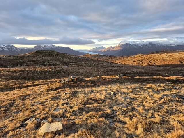
Bidein Clann Raonaild — the MacRanalds' clan peak — rises to 466m at NH 053 591 above Loch a' Chroisg between Achnasheen and Kinlochewe. The MacRanald name attached to a small group of associated families and the hill, modest in height, has a steep little summit cone that earns the bidein suffix.
Quick facts
- Height
- 466m/ 1529ft
- Prominence
- 230 m
- Grid ref
- NH 05376 59184
- Nearest city
- Inverness· 63km
- Dogs
- Dogs on lead required near livestockDog-friendly guide ↗
Height and prominence cross-checked against the Database of British and Irish Hills (CC BY).
No GPX track yet
Walked this route? Share your track to help other walkers.
Standard route
heather moorland 55% · rocky slopes 30% · grass slopes 15%
Park beside the A832 at the east end of Loch a' Chroisg. Climb directly north up rough heather slopes to the small summit pyramid. A short, sharp 2-3 hour outing.
Terrain
Tall wet heather on the lower slopes with hidden boulders — slow going. The summit pyramid is firmer with short grass and small quartzite outcrops. No path.
In winter
Position above Loch a' Chroisg means it catches snow shower bands rolling east from An Teallach. Lying snow is patchy but the steep little summit cone can be greasy when iced. Walking poles useful.
This hill is in the Torridon SAIS forecast area. Check SAIS forecasts in winter (December–April).
Best time of year
Getting there
- Glasgow5h 9m
- Edinburgh7h 49m
OS maps: OS Landranger 25, OS Explorer 435S
Mobile signal: Weak. zero EE on summit; Torridon/Fisherfield area is a well-known dead zone.
Current conditions
Daylight Today
- Sunrise
- 05:12
- Sunset
- 21:43
- Civil dawn
- 04:19
- Civil dusk
- 22:36
NOAA Solar Calculator · 30 July 2026
Around Bidein Clann Raonaild on the SCOT network
Getting there, basing yourself, and what to do off the hill.
Bidein Clann Raonaild — common questions
- How hard is Bidein Clann Raonaild?
- We grade Bidein Clann Raonaild at 1/5, which puts it in easy territory. Terrain: Tall wet heather on the lower slopes with hidden boulders — slow going.
- How prominent is Bidein Clann Raonaild?
- Bidein Clann Raonaild has 230m of topographic prominence — the height of its summit above the highest col connecting it to higher ground. Marilyns are defined by that measure: at least 150m of drop on all sides.
- When should I climb Bidein Clann Raonaild?
- The standard good-weather months for Bidein Clann Raonaild are March, April, May, June, July, August, September, October. Outside those months, expect winter conditions on the high ground — full mountain kit, navigation skills, and a check of the SAIS avalanche forecast for the relevant region.
- Can I bring my dog up Bidein Clann Raonaild?
- On a lead only — the route crosses ground with livestock or nesting-bird interest.
- What's mobile reception like on Bidein Clann Raonaild?
- Weak. zero EE on summit; Torridon/Fisherfield area is a well-known dead zone.
- Is Bidein Clann Raonaild safe in winter?
- Position above Loch a' Chroisg means it catches snow shower bands rolling east from An Teallach. Lying snow is patchy but the steep little summit cone can be greasy when iced. Walking poles useful.
Get the OutdoorSCOT weekly
One email a week — new route, hill and bothy guides, seasonal conditions and the odd hard-won lesson. No spam, unsubscribe in one click.