Marilyn · Galloway
Bengairn
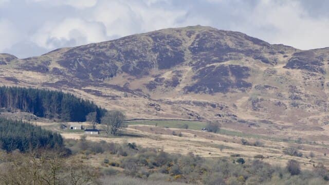
Bengairn rises to 391m on the NX-grid coastal hills above Auchencairn Bay in the Stewartry. Paired with neighbouring Screel Hill, it forms one of the most popular short hill days in eastern Galloway.
Quick facts
- Height
- 391m/ 1283ft
- Prominence
- 340 m
- Grid ref
- NX 77061 54514
- Nearest city
- Dumfries· 30km
- Dogs
- Dogs on lead required near livestockDog-friendly guide ↗
Height and prominence cross-checked against the Database of British and Irish Hills (CC BY).
No GPX track yet
Walked this route? Share your track to help other walkers.
Standard route
heather moorland 60% · rough grassland 30% · rocky summit 10%
The standard line begins at the Screel forest car park east of Palnackie, climbing forest trails before breaking onto open ground for the final ridge. Three hours covers the rocky round across both summits.
Terrain
Forest path on the approach gives way to granite slabs, heather and gorse around the upper section. The summit ridge has scattered cairns and rock outcrops.
In winter
Sea breezes keep heavy snow rare, but glazed granite slabs become slippery in frost. A short ice axe is occasional comfort, more often unneeded.
Best time of year
Getting there
- Glasgow3h 42m
- Edinburgh3h 22m
OS maps: OS Landranger 84, OS Explorer 312
Mobile signal: Moderate. Galloway; EE reasonable near Castle Douglas.
Current conditions
Daylight Today
- Sunrise
- 05:21
- Sunset
- 21:23
- Civil dawn
- 04:34
- Civil dusk
- 22:10
NOAA Solar Calculator · 30 July 2026
Around Bengairn on the SCOT network
Getting there, basing yourself, and what to do off the hill.
Bengairn — common questions
- How difficult is Bengairn?
- Bengairn carries a 1/5 (easy) grade on the OutdoorSCOT scale. Ground conditions: Forest path on the approach gives way to granite slabs, heather and gorse around the upper section.
- How much drop does Bengairn have?
- The drop is 340m: measured from the summit of Bengairn down to the saddle joining it to higher terrain. Passing the 150m-drop threshold on all sides is exactly what makes it a Marilyn.
- What's the best month to climb Bengairn?
- Aim for March, April, May, June, July, August, September, October on Bengairn. In the remaining months treat it as a winter hill — full kit, solid navigation, and a look at the relevant SAIS avalanche forecast before you go.
- Can dogs go up Bengairn?
- Dogs are fine on a lead. The route passes livestock or ground-nesting bird habitat, so keep them close throughout.
- Will I get phone signal on Bengairn?
- Moderate. Galloway; EE reasonable near Castle Douglas.
- Is Bengairn safe in winter?
- Sea breezes keep heavy snow rare, but glazed granite slabs become slippery in frost. A short ice axe is occasional comfort, more often unneeded.
Get the OutdoorSCOT weekly
One email a week — new route, hill and bothy guides, seasonal conditions and the odd hard-won lesson. No spam, unsubscribe in one click.