Marilyn · North-West Highlands
Ben Dreavie
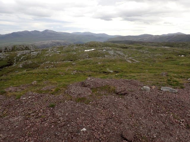
Ben Dreavie stands above Loch Stack Lodge on the southern edge of the Cape Wrath wilderness, north of the A838 between Laxford Bridge and Durness. The NC 26 39 location gives it a panorama of Foinaven's ridge and the loch-strewn ground around Loch a' Garbh-bhaid Mor.
Quick facts
- Height
- 512.2m/ 1680ft
- Prominence
- 240 m
- Grid ref
- NC 26100 39829
- Dogs
- Dogs on lead required near livestockDog-friendly guide ↗
Height and prominence cross-checked against the Database of British and Irish Hills (CC BY).
No GPX track yet
Walked this route? Share your track to help other walkers.
Standard route
blanket bog 55% · heather moorland 30% · rocky summit 15%
Park near the bridge at Achfary or at Laxford Bridge (NC 23 46) and follow the public path eastwards before turning south up the heathery west ridge. A small cairn marks the top above a band of low crags. Around 11 km return with 480m of climb.
Terrain
Deep heather on the lower ridge gives way to short turf and gneiss outcrops above 350m. The flanks hold numerous lochans and seepage lines that need careful weaving in wet weather.
In winter
The hill is exposed to direct Atlantic weather and rime forms readily on the summit knolls. In hard frost the approach across boggy ground becomes much easier, but spindrift drifts behind the crags can be deep.
This hill is in the Torridon SAIS forecast area. Check SAIS forecasts in winter (December–April).
Best time of year
Getting there
- Glasgow7h 37m
- Edinburgh8h 39m
OS maps: OS Landranger 15, OS Explorer 445
Mobile signal: Poor. No reliable signal on summit or approach. Emergency contacts before departure.
Current conditions
Daylight Today
- Sunrise
- 05:07
- Sunset
- 21:46
- Civil dawn
- 04:11
- Civil dusk
- 22:42
NOAA Solar Calculator · 30 July 2026
Around Ben Dreavie on the SCOT network
Getting there, basing yourself, and what to do off the hill.
Ben Dreavie — common questions
- What difficulty is Ben Dreavie?
- On the OutdoorSCOT scale, Ben Dreavie comes in at 2/5 — moderate. Terrain: Deep heather on the lower ridge gives way to short turf and gneiss outcrops above 350m.
- How prominent is Ben Dreavie?
- Ben Dreavie has 240m of topographic prominence — the height of its summit above the highest col connecting it to higher ground. Marilyns are defined by that measure: at least 150m of drop on all sides.
- When should I climb Ben Dreavie?
- The standard good-weather months for Ben Dreavie are March, April, May, June, July, August, September, October. Outside those months, expect winter conditions on the high ground — full mountain kit, navigation skills, and a check of the SAIS avalanche forecast for the relevant region.
- Can I bring my dog up Ben Dreavie?
- On a lead only — the route crosses ground with livestock or nesting-bird interest.
- What's mobile reception like on Ben Dreavie?
- Poor. No reliable signal on summit or approach. Emergency contacts before departure.
- Is Ben Dreavie safe in winter?
- The hill is exposed to direct Atlantic weather and rime forms readily on the summit knolls. In hard frost the approach across boggy ground becomes much easier, but spindrift drifts behind the crags can be deep.
Get the OutdoorSCOT weekly
One email a week — new route, hill and bothy guides, seasonal conditions and the odd hard-won lesson. No spam, unsubscribe in one click.