Marilyn · North-West Highlands
Feinne-bheinn Mhor
Feinne-bheinn Mhor — "big Fingal's hill" — is a 465m whaleback in the NC43 square between Loch Hope and Loch Loyal. Its name links it to the mythical warrior Fingal said to have hunted these moors.
Gaelic: “big” · Pronunciation: feinne bheinn vore
Quick facts
- Height
- 465m/ 1526ft
- Prominence
- 178 m
- Grid ref
- NC 43440 46264
- Dogs
- Dogs on lead required near livestockDog-friendly guide ↗
Height and prominence cross-checked against the Database of British and Irish Hills (CC BY).
No GPX track yet
Walked this route? Share your track to help other walkers.
Standard route
blanket bog 55% · heather moorland 30% · rocky summit 15%
Park beside Loch Hope on the single-track Tongue road, then strike pathless eastwards across the Allt Crom-allt to the western shoulder. Roughly 5 hours for the round.
Terrain
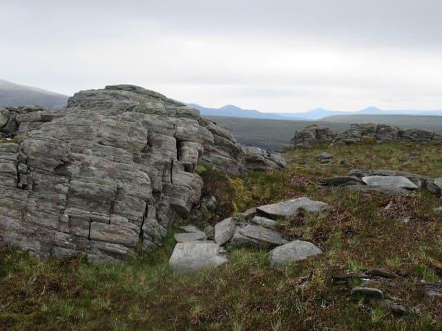
Open peat moor with occasional gneiss reefs surfacing through the heather. River crossings on the approach can be impassable after heavy rain.
In winter
A frozen Allt Crom-allt makes life easier. The summit is exposed to north-westerly storms straight off Cape Wrath; turn back rather than risk a windward descent.
Best time of year
Getting there
- Glasgow7h 36m
- Edinburgh7h 22m
OS maps: OS Landranger 9, OS Explorer 447S
Mobile signal: Poor. No coverage across this remote Flow Country hill.
Current conditions
Daylight Today
- Sunrise
- 06:45
- Sunset
- 19:44
- Civil dawn
- 06:05
- Civil dusk
- 20:24
NOAA Solar Calculator · 14 September 2026
Around Feinne-bheinn Mhor on the SCOT network
Getting there, basing yourself, and what to do off the hill.
Feinne-bheinn Mhor — common questions
- Is Feinne-bheinn Mhor a hard climb?
- Feinne-bheinn Mhor is rated 1/5 (easy) on the OutdoorSCOT scale. Underfoot: Open peat moor with occasional gneiss reefs surfacing through the heather.
- What is Feinne-bheinn Mhor's prominence?
- 178m of prominence. That's the vertical drop from the summit to the col that links Feinne-bheinn Mhor to the next higher ground. That drop is what qualifies it as a Marilyn — a hill with at least 150m of descent on every side.
- When is the best time to climb Feinne-bheinn Mhor?
- March, April, May, June, July, August, September, October give the most reliable conditions on Feinne-bheinn Mhor. Beyond that window the high ground turns wintry: carry full mountain kit, be confident navigating, and check the SAIS avalanche forecast for the area.
- Is Feinne-bheinn Mhor dog-friendly?
- Yes, but dogs must be kept on a lead — there is livestock or ground-nesting bird interest on the route.
- Is there mobile signal on Feinne-bheinn Mhor?
- Poor. No coverage across this remote Flow Country hill.
- Is Feinne-bheinn Mhor safe in winter?
- A frozen Allt Crom-allt makes life easier. The summit is exposed to north-westerly storms straight off Cape Wrath; turn back rather than risk a windward descent.
Get the OutdoorSCOT weekly
One email a week — new route, hill and bothy guides, seasonal conditions and the odd hard-won lesson. No spam, unsubscribe in one click.