Marilyn · Argyll
Beinn Bhreac
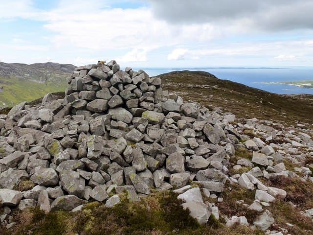
This Beinn Bhreac is the more southerly of the Knapdale Speckled Hills, sitting at 441m above the Sound of Jura. It is a quiet rounded summit surrounded by lochans and rough pasture, with Jura filling the western horizon.
Quick facts
- Height
- 441m/ 1447ft
- Grid ref
- NR 53326 77885
- Dogs
- Dogs on lead required near livestockDog-friendly guide ↗
No GPX track yet
Walked this route? Share your track to help other walkers.
Standard route
heather moorland 65% · boggy ground 20% · grassy summit 15%
A short outing from the minor road that wriggles south of Tayvallich. Most parties pick a rough line up the eastern flank, taking 3 hours for the round trip.
Terrain
Extensive heather and peat hags. Lochans dot the surrounding moor — useful navigation landmarks in clear weather.
In winter
Snow is rare on the low Knapdale hills but the bog and tussock become harder underfoot when partly frozen, making winter walking surprisingly pleasant.
Best time of year
Getting there
- Glasgow4h 24m
- Edinburgh7h 9m
Ferry access
Kennacraig → Port Askaig (Islay) then Port Askaig → Feolin (Jura)
- Crossing time145 min
- Summer sailingsIslay: 1–2 CalMac sailings daily. Jura ferry: frequent throughout the day
- Winter sailingsIslay: 1 CalMac sailing daily. Jura ferry: reduced but regular
- Book ahead21 days
- Last ferry backLast Jura ferry ~17:00; last Islay sailing varies — check both timetables
Two ferries required: CalMac Kennacraig → Port Askaig (2h15), then the short Jura passenger ferry (10 min) from Port Askaig to Feolin. No car needed once on Jura for the Paps.
Book on ferry operator ↗OS maps: OS Landranger 61, OS Explorer 355S
Mobile signal: Poor. South Knapdale interior; EE absent. Lochgilphead is the nearest coverage.
Current conditions
Daylight Today
- Sunrise
- 04:40
- Sunset
- 22:14
- Civil dawn
- 03:38
- Civil dusk
- 23:16
NOAA Solar Calculator · 27 June 2026
Around Beinn Bhreac on the SCOT network
Getting there, basing yourself, and what to do off the hill.
Beinn Bhreac — common questions
- How hard is Beinn Bhreac?
- Beinn Bhreac is rated 1/5 (easy) on the OutdoorSCOT scale. Terrain: Extensive heather and peat hags.
- When is the best time to climb Beinn Bhreac?
- The standard good-weather months for Beinn Bhreac are March, April, May, June, July, August, September, October. Outside those months, expect winter conditions on the high ground — full mountain kit, navigation skills, and a check of the SAIS avalanche forecast for the relevant region.
- Can I bring my dog up Beinn Bhreac?
- Yes, but dogs must be kept on a lead — there is livestock or ground-nesting bird interest on the route.
- Is there mobile signal on Beinn Bhreac?
- Poor. South Knapdale interior; EE absent. Lochgilphead is the nearest coverage.
- How do I get the ferry to Beinn Bhreac?
- Kennacraig → Port Askaig (Islay) then Port Askaig → Feolin (Jura). Islay: 1–2 CalMac sailings daily. Jura ferry: frequent throughout the day in summer; Islay: 1 CalMac sailing daily. Jura ferry: reduced but regular in winter. Book at least 21 days ahead. Two ferries required: CalMac Kennacraig → Port Askaig (2h15), then the short Jura passenger ferry (10 min) from Port Askaig to Feolin. No car needed once on Jura for the Paps.
- Is Beinn Bhreac safe in winter?
- Snow is rare on the low Knapdale hills but the bog and tussock become harder underfoot when partly frozen, making winter walking surprisingly pleasant.
Get the OutdoorSCOT weekly
One email a week — new route, hill and bothy guides, seasonal conditions and the odd hard-won lesson. No spam, unsubscribe in one click.