Marilyn · Outer Hebrides
Beinn a' Charnain
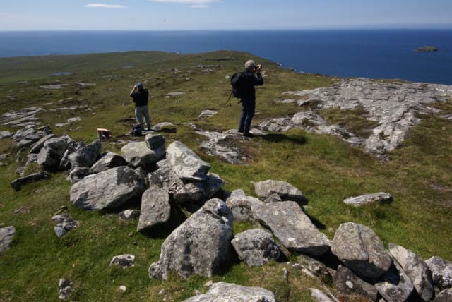
The cairned hill of Berneray sits at 196m as the highest point of this little island linked to North Uist by a causeway. Tiny in scale, it gives an outsized panorama across the Sound of Harris and back to the Uist hills.
Quick facts
- Height
- 196m/ 643ft
- Prominence
- 196 m
- Grid ref
- NF 89395 88459
- Dogs
- Dogs on lead required near livestockDog-friendly guide ↗
Height and prominence cross-checked against the Database of British and Irish Hills (CC BY).
No GPX track yet
Walked this route? Share your track to help other walkers.
Standard route
blanket bog 50% · Lewisian gneiss 35% · rocky summit 15%
From Berneray village a track and then open ground leads onto the modest summit ridge. Reckon on an hour each way, with plenty of time to wander to the famous West Beach afterwards.
Terrain
Springy turf, low heather and rocky outcrops with very little bog underfoot. The cairn-strewn summit is a delight to wander.
In winter
About as benign as Hebridean hill-walking gets, accessible whenever the weather allows the causeway crossing. Wind off the Atlantic remains the only real consideration.
Best time of year
Getting there
- Glasgow9h 10m
- Edinburgh11h 28m
OS maps: OS Landranger 18, OS Explorer 455
Mobile signal: Poor. Networks don't reach this summit; download maps at Lochboisdale before leaving.
Current conditions
Daylight Today
- Sunrise
- 05:19
- Sunset
- 21:52
- Civil dawn
- 04:25
- Civil dusk
- 22:46
NOAA Solar Calculator · 30 July 2026
Around Beinn a' Charnain on the SCOT network
Getting there, basing yourself, and what to do off the hill.
Beinn a' Charnain — common questions
- Is Beinn a' Charnain a hard climb?
- Beinn a' Charnain is rated 1/5 (easy) on the OutdoorSCOT scale. Underfoot: Springy turf, low heather and rocky outcrops with very little bog underfoot.
- What is Beinn a' Charnain's prominence?
- Beinn a' Charnain's prominence is its full height — 196m — because it is the highest point of its landmass, with no higher ground connected to it. That drop is what qualifies it as a Marilyn — a hill with at least 150m of descent on every side.
- When is the best time to climb Beinn a' Charnain?
- March, April, May, June, July, August, September, October give the most reliable conditions on Beinn a' Charnain. Beyond that window the high ground turns wintry: carry full mountain kit, be confident navigating, and check the SAIS avalanche forecast for the area.
- Is Beinn a' Charnain dog-friendly?
- Yes, but dogs must be kept on a lead — there is livestock or ground-nesting bird interest on the route.
- Is there mobile signal on Beinn a' Charnain?
- Poor. Networks don't reach this summit; download maps at Lochboisdale before leaving.
- Is Beinn a' Charnain safe in winter?
- About as benign as Hebridean hill-walking gets, accessible whenever the weather allows the causeway crossing. Wind off the Atlantic remains the only real consideration.
Get the OutdoorSCOT weekly
One email a week — new route, hill and bothy guides, seasonal conditions and the odd hard-won lesson. No spam, unsubscribe in one click.