Marilyn · Outer Hebrides
Beinn Mhor
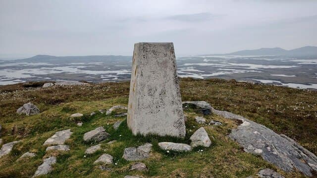
This Beinn Mhor — distinct from its taller South Uist namesake — is a 190m gneiss summit on the eastern peninsula of North Uist near Lochmaddy. The hill commands views over Loch nam Madadh and across to the Skye Cuillin in good weather.
Gaelic: “mountain, big” · Pronunciation: bine vore
Quick facts
- Height
- 190m/ 623ft
- Grid ref
- NF 89801 76156
- Dogs
- Dogs on lead required near livestockDog-friendly guide ↗
No GPX track yet
Walked this route? Share your track to help other walkers.
Standard route
Lewisian gneiss 50% · rough grassland 30% · blanket bog 20%
Best tackled from a parking spot on the B894 east of Lochmaddy, crossing rough moor and gneiss slabs to the broad summit. A two-to-three-hour outing depending on how much wandering you indulge in along the way.
Terrain
Knolly Lewisian gneiss bedrock with peaty hollows filling every depression. There are no paths and many false summits to work around.
In winter
Sheltered to a degree by the eastern peninsulas, this hill catches the worst of any easterly weather rolling off the Minch. Snow seldom lies; gales and saturated ground are the seasonal staples.
Best time of year
Getting there
- Glasgow9h 58m
- Edinburgh11h 18m
Ferry access
Uig (Skye) → Lochmaddy (North Uist)
- Crossing time105 min
- Summer sailings2 sailings daily (Apr–Oct)
- Winter sailings1 sailing daily (Nov–Mar)
- Book ahead14 days
- Last ferry backCheck CalMac timetable
The Western Isles causeways link North Uist, Benbecula, and South Uist — drive between them once on the island.
Book on CalMac ↗OS maps: OS Landranger 18, OS Explorer 454E
Mobile signal: Poor. Harris; limited coverage in remote glens.
Current conditions
Daylight Today
- Sunrise
- 04:31
- Sunset
- 22:33
- Civil dawn
- 03:18
- Civil dusk
- 23:45
NOAA Solar Calculator · 27 June 2026
Around Beinn Mhor on the SCOT network
Getting there, basing yourself, and what to do off the hill.
Beinn Mhor — common questions
- How hard is Beinn Mhor?
- Beinn Mhor is rated 1/5 (easy) on the OutdoorSCOT scale. Terrain: Knolly Lewisian gneiss bedrock with peaty hollows filling every depression.
- When is the best time to climb Beinn Mhor?
- The standard good-weather months for Beinn Mhor are March, April, May, June, July, August, September, October. Outside those months, expect winter conditions on the high ground — full mountain kit, navigation skills, and a check of the SAIS avalanche forecast for the relevant region.
- Can I bring my dog up Beinn Mhor?
- Yes, but dogs must be kept on a lead — there is livestock or ground-nesting bird interest on the route.
- Is there mobile signal on Beinn Mhor?
- Poor. Harris; limited coverage in remote glens.
- How do I get the ferry to Beinn Mhor?
- Uig (Skye) → Lochmaddy (North Uist). 2 sailings daily (Apr–Oct) in summer; 1 sailing daily (Nov–Mar) in winter. Book at least 14 days ahead. The Western Isles causeways link North Uist, Benbecula, and South Uist — drive between them once on the island.
- Is Beinn Mhor safe in winter?
- Sheltered to a degree by the eastern peninsulas, this hill catches the worst of any easterly weather rolling off the Minch. Snow seldom lies; gales and saturated ground are the seasonal staples.
Get the OutdoorSCOT weekly
One email a week — new route, hill and bothy guides, seasonal conditions and the odd hard-won lesson. No spam, unsubscribe in one click.