Graham · Far North
Morven
Morven (706m) is the high point of Caithness at ND00, a near-conical sandstone peak rising from the Flow Country flatlands like an island from the sea. From any direction in the county the distinctive triangular profile is unmistakable. Its 576m prominence is extraordinary for its modest summit height and the view from the top spans the Pentland Firth, Orkney on a clear day, and inland to Ben Klibreck and Morrich Mor.
Quick facts
- Height
- 706m/ 2316ft
- Prominence
- 576 m
- Distance
- 13 km
- Ascent
- 579 m
- Time
- 4–6 hrs
- Grid ref
- ND004285
- Parking
- ND075280
- Nearest city
- Inverness· 90km
- Dogs
- Dogs on lead required near livestockDog-friendly guide ↗
Height and prominence cross-checked against the Database of British and Irish Hills (CC BY).
No GPX track yet
Walked this route? Share your track to help other walkers.
Standard route
heather moorland 70% · grass slopes 20% · summit rocks 10%
From the Braemore road end at the upper end of the Berriedale public road, a track climbs north-west across grouse moor before the steep direct ascent of the south-east face. 13km return on the standard line, 579m of climbing concentrated in the final 2km.
Terrain
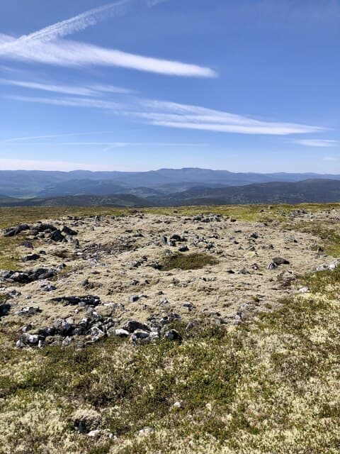
Lower estate tracks give easy progress on managed grouse moor. The steep upper cone is on sandstone scree and short turf with patches of crowberry. The rocky summit cap is a small flat platform with extraordinary 360-degree visibility. Take care descending the loose scree on the south-east face.
In winter
Caithness sits closer to the Arctic Circle than any other county. Short daylight in December — barely six and a half hours — and full exposure to North Sea storms make Morven a serious winter outing despite its modest height. SAIS Northern Highlands doesn't extend this far north but the hill collects deep windslab on lee aspects in northerly events.
Best time of year
Getting there
- Glasgow5h 7m
- Edinburgh5h 55m
OS maps: OS Landranger 17
Mobile signal: Good signal on the conspicuous summit — clear line of sight to Wick, Thurso and the Pentland Firth masts.
Current conditions
Daylight Today
- Sunrise
- 04:30
- Sunset
- 22:11
- Civil dawn
- 03:23
- Civil dusk
- 23:18
NOAA Solar Calculator · 13 July 2026
Around Morven on the SCOT network
Getting there, basing yourself, and what to do off the hill.
Morven — common questions
- Is Morven a hard climb?
- Morven is rated 4/5 (challenging) on the OutdoorSCOT scale. The standard route covers about 13km with 579m of ascent and takes most walkers 4-6 hours. Terrain: Lower estate tracks give easy progress on managed grouse moor.
- How prominent is Morven?
- Morven has 576m of topographic prominence — the height of its summit above the highest col connecting it to higher ground.
- Where should I park to climb Morven?
- Standard parking is at ND075280. Check the parking grid reference on an OS map before travel; informal laybys can fill on summer weekends.
- When should I climb Morven?
- The standard good-weather months for Morven are May, June, July, August, September. Outside those months, expect winter conditions on the high ground — full mountain kit, navigation skills, and a check of the SAIS avalanche forecast for the relevant region.
- Can I bring my dog up Morven?
- On a lead only — the route crosses ground with livestock or nesting-bird interest.
- What's mobile reception like on Morven?
- Good signal on the conspicuous summit — clear line of sight to Wick, Thurso and the Pentland Firth masts.
- Is Morven safe in winter?
- Caithness sits closer to the Arctic Circle than any other county. Short daylight in December — barely six and a half hours — and full exposure to North Sea storms make Morven a serious winter outing despite its modest height. SAIS Northern Highlands doesn't extend this far north but the hill collects deep windslab on lee aspects in northerly events.
Get the OutdoorSCOT weekly
One email a week — new route, hill and bothy guides, seasonal conditions and the odd hard-won lesson. No spam, unsubscribe in one click.