Glen
Glen Cluanie
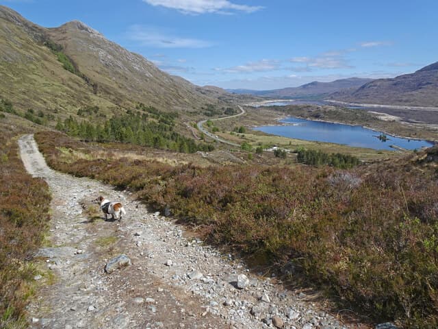
The continuation of Glen Shiel east of Cluanie Inn — Loch Cluanie reservoir with the Cluanie horseshoe to the north and the South Cluanie Ridge to the south.
- Length
- 12km
- Munros
- 5
- Corbetts
- 1
- Highest peak
- Sgurr nan Conbhairean (1109m)
Glen Cluanie carries the A87 east from the Cluanie Inn down to the junction with the A887 at Loch Garry. Most of the glen floor is taken by Loch Cluanie, a hydro reservoir formed in 1957 — the original glen road, the houses at the head of the loch, and the old Cluanie Inn are all underwater. The current Cluanie Inn sits at the west end of the loch, marking the watershed between Cluanie's east-flowing drainage and Glen Shiel's west-flowing one.
The hills on either side are the same ridges that bound Glen Shiel — the South Cluanie Ridge to the south, the Cluanie horseshoe (A' Chralaig, Mullach Fraoch-choire, Ciste Dhubh) to the north — so most walkers planning Glen Shiel routes start from Cluanie Inn laybys regardless of which glen the parking technically sits in.
The road in
Parking1 spot
Cluanie Inn layby
20 cars
Free
Shared with Glen Shiel — the inn sits on the watershed.
Hills from Glen Cluanie5 Munros · 1 Corbetts
What's in the glen
Loch Cluanie
Hydro reservoir formed in 1957. The original Glen Cluanie road, settlements and the old Cluanie Inn lie beneath the water — the present inn at the west end was built when the dam was constructed.
River Loyne / River Cluanie
Our take
Treat Glen Cluanie as part of the same operational unit as Glen Shiel. The Cluanie Inn is the obvious base for both glens; the South Cluanie Ridge Munros are reached from laybys along the A87 in either direction. The reservoir itself is functional rather than beautiful — the dammed loch lacks the character of a natural Highland water — but the surrounding ridges are first-rate. Park at Cluanie Inn and walk out to whichever ridge you want.
Practical
- Mobile signal
- Good signal along the A87 corridor through the glen.
- Midges
- Moderate(3/5)
- Stalking estate
- Glenquoich and Cluanie estates (private)Stalking active 1 Jul – 20 Oct
- Check Heading for the Hills before going. Many private sporting estates ask walkers to phone ahead or choose alternative routes on shoot days.
- Public transport
- CityLink 917 (Glasgow–Skye) runs the length of the glen. Stops at Cluanie Inn.
- Dogs
- On lead — livestock or ground-nesting birds present.
Map
Hills (green), bothies (brown), parking (blue), wild swimming (light blue).
Nearby glens
Scotland outdoor updates
Route guides, condition reports and seasonal picks — once a month, no noise.
Glen Cluanie — common questions
- What kind of road runs through Glen Cluanie?
- A-road for the full length. Build in extra time for the approach.
- Can I take a motorhome or campervan into Glen Cluanie?
- Glen Cluanie works for motorhomes and campervans. Just take the single-track stretches steadily and use the passing places so local traffic can get past.
- Are there midges in Glen Cluanie?
- Expect a significant midge season in Glen Cluanie (3/5), running late May to September. The worst of it comes on sheltered, humid evenings — breezy spots and the high tops stay clearer. Smidge and a head net earn their place from May onwards.
- Can I wild camp in Glen Cluanie?
- You can. Scotland's Land Reform Act 2003 gives a right to wild camp on most unenclosed land, subject to the Scottish Outdoor Access Code: stay off enclosed agricultural ground, keep numbers small, leave no trace. Note the Loch Lomond and Trossachs Camping Management Zones and their seasonal restrictions do not cover Glen Cluanie.
- Can I get to Glen Cluanie without a car?
- CityLink 917 (Glasgow–Skye) runs the length of the glen. Stops at Cluanie Inn.