Marilyn · Glen Coe & Lochaber
Beinn na h-Uamha
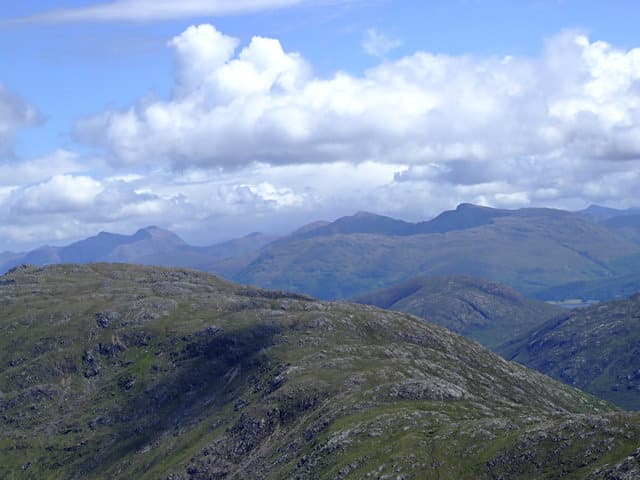
Beinn na h-Uamha, the Hill of the Cave, sits at 465m above Loch Sunart in deepest Morvern. The cave from which it takes its name is tucked into the rocky upper slopes, looking out across the sea loch toward Ardnamurchan.
Quick facts
- Height
- 465m/ 1526ft
- Prominence
- 240 m
- Grid ref
- NM 68206 53431
- Nearest city
- Oban· 29km
- Dogs
- Dogs on lead required near livestockDog-friendly guide ↗
Height and prominence cross-checked against the Database of British and Irish Hills (CC BY).
No GPX track yet
Walked this route? Share your track to help other walkers.
Standard route
heather and bog 55% · rocky slopes 30% · grass slopes 15%
Most parties start from the Liddesdale road near Loch Sunart and follow the burn uphill through scattered oakwood before climbing rough heathery slopes to the summit. There is no formed path; allow 3 to 5 hours for the round trip.
Terrain
Oak and birch on the lower ground give way to wet heather, peat hags and small crags higher up. The cave-bearing summit area has loose rock that warrants care.
In winter
Sits close enough to the sea that lying snow rarely lasts, but slick frozen heather and ice-glazed crags can make winter ascents trickier than the height suggests.
This hill is in the Glen Coe SAIS forecast area. Check SAIS forecasts in winter (December–April).
Best time of year
Getting there
- Glasgow4h 25m
- Edinburgh7h 55m
OS maps: OS Landranger 49, OS Explorer 383W
Mobile signal: Minimal. signal falls away en route; Ardgour hills block all networks.
Current conditions
Daylight Today
- Sunrise
- 05:20
- Sunset
- 21:40
- Civil dawn
- 04:29
- Civil dusk
- 22:30
NOAA Solar Calculator · 30 July 2026
Around Beinn na h-Uamha on the SCOT network
Getting there, basing yourself, and what to do off the hill.
Getting there: Oban station
Argyll ferry hub; Mull, Lismore, Coll, Tiree, Barra connections
29km from the hill
tripscot.co.uk
On TripSCOTBase yourself in Tobermory
Mull base — Ben More, Treshnish, ferry to Iona
18km from the hill
tripscot.co.uk
On TasteSCOTAfter the hill: Tobermory
Mull — colourful harbour-front distillery making both unpeated and peated (Ledaig) whisky
18km from the hill
tastescot.co.uk
Beinn na h-Uamha — common questions
- What difficulty is Beinn na h-Uamha?
- On the OutdoorSCOT scale, Beinn na h-Uamha comes in at 1/5 — easy. Underfoot: Oak and birch on the lower ground give way to wet heather, peat hags and small crags higher up.
- What is Beinn na h-Uamha's prominence?
- 240m of prominence. That's the vertical drop from the summit to the col that links Beinn na h-Uamha to the next higher ground. That drop is what qualifies it as a Marilyn — a hill with at least 150m of descent on every side.
- When is the best time to climb Beinn na h-Uamha?
- March, April, May, June, July, August, September, October give the most reliable conditions on Beinn na h-Uamha. Beyond that window the high ground turns wintry: carry full mountain kit, be confident navigating, and check the SAIS avalanche forecast for the area.
- Is Beinn na h-Uamha dog-friendly?
- Yes, but dogs must be kept on a lead — there is livestock or ground-nesting bird interest on the route.
- Is there mobile signal on Beinn na h-Uamha?
- Minimal. signal falls away en route; Ardgour hills block all networks.
- Is Beinn na h-Uamha safe in winter?
- Sits close enough to the sea that lying snow rarely lasts, but slick frozen heather and ice-glazed crags can make winter ascents trickier than the height suggests.
Get the OutdoorSCOT weekly
One email a week — new route, hill and bothy guides, seasonal conditions and the odd hard-won lesson. No spam, unsubscribe in one click.